Barra do Ribeiro — São Miguel dos Campos
Barra do Ribeiro — Glorinha
Barra do Ribeiro — Pouso Novo
Barra do Ribeiro — Jaguaruna
Barra do Ribeiro — Itapipoca
Barra do Ribeiro — Paraisópolis
Barra do Ribeiro — Cândido de Abreu
Barra do Ribeiro — Tabapuã
Barra do Ribeiro — Corumbataí
Barra do Ribeiro — Cedro
Barra do Ribeiro — Carmo de Minas
Barra do Ribeiro — Erechim
Barra do Ribeiro — Joinville Airport - Lauro Carneiro de Loyola
Barra do Ribeiro — Espinho
Barra do Ribeiro — Ubaporanga
Barra do Ribeiro — Itapoá
Barra do Ribeiro — Monteiro
Barra do Ribeiro — Itatiaia do Alto Bonito
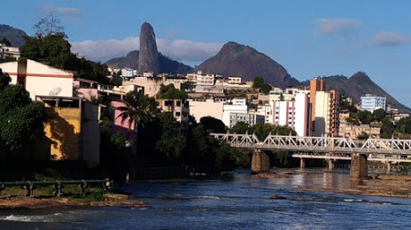
Barra do Ribeiro — Cachoeiro de Itapemirim distance, route on the map
Distance by car
Distance between Barra do Ribeiro, Rio Grande do Sul, Brazil and Cachoeiro de Itapemirim, Espírito Santo, Brazil by car is — km, or miles. To travel this distance by car, you need minute, or h.
Route on the map, driving directions
Car route Barra do Ribeiro — Cachoeiro de Itapemirim was created automatically. The road on the map is shown as a blue line. By moving the markers, you can create a new route through the points you need.
Distance by plane
If you decide to take a trip Barra do Ribeiro Cachoeiro de Itapemirim by plane, then you have to fly the distance — 1465 km or 908 miles. It is marked on the map with a gray line (between two points in a straight line).
Flight time
Estimated flight time Barra do Ribeiro Cachoeiro de Itapemirim by plane at cruising speed 750 km / h will be — 1 h. and 57 min.
Direction of movement
Brazil, Barra do Ribeiro — right-hand traffic. Brazil, Cachoeiro de Itapemirim — right-hand traffic.
Difference in time
Barra do Ribeiro and Cachoeiro de Itapemirim are in the same time zone. Between them there is no time difference (UTC -3 America/Sao_Paulo).
Interesting Facts
Information on alternative ways to get to your destination.
The length of this distance is about 3.7% of the total length of the equator.
The percentage of the population is clearly shown in the graph:
Barra do Ribeiro — 10,889 (less by 176,134), Cachoeiro de Itapemirim — 187,023 residents.
The cost of travel
Calculate the cost of the trip yourself using the fuel consumption calculator, changing the data in the table.