
 Józefów nad Wisłą
Gorzyce Wielkie
Rogówek
Sromowce Niżne
Wyszków County
Kruszewo
Jantar
Sady Górne
Nagoszewo
Józefów nad Wisłą
Gorzyce Wielkie
Rogówek
Sromowce Niżne
Wyszków County
Kruszewo
Jantar
Sady Górne
Nagoszewo
Porcelain Museum in Wałbrzych on the map, Walbrzych, Poland
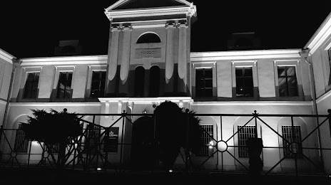
Photo
Where is located Porcelain Museum in Wałbrzych
Porcelain Museum in Wałbrzych — local attraction, which is located at 1 Maja 9, 58-300 Wałbrzych, Poland and belongs to the category — museum. Average visitor rating for this place — 4.5 (according to 803 ratings, information from open sources and relevant for 2022).
Exact location — Porcelain Museum in Wałbrzych, marked on the map with a red marker.
You can get directions to Porcelain Museum in Wałbrzych on the map from your location.
What else is interesting in Walbrzych? You can see all the sights if you go to the city page.
Coordinates
Porcelain Museum in Wałbrzych, Poland coordinates in decimal format: latitude — 50.76544814964653, longitude — 16.279914598267784. When converted to degrees, minutes, seconds Porcelain Museum in Wałbrzych has the following coordinates: 50°45′55.61 north latitude and 16°16′47.69 east longitude.
Nearby cities
The largest cities that are located nearby:
- Legnica — 48 km
- Wrocław — 63 km
- Opole — 115 km
- Zielona Gora — 138 km
- Olomouc
 (Czech Republic) — 149 km
 - Prague (Czech Republic) — 153 km
- Kalisz — 164 km
- Cottbus
 (Germany) — 171 km
 - Ostrava (Czech Republic) — 177 km
- Gliwice — 177 km
- Brno (Czech Republic) — 177 km
- Rybnik — 177 km
- Dresden (Germany) — 179 km
- Zabrze — 184 km
- Poznań — 185 km
- Ruda Slaska — 191 km
- Bytom — 192 km
- Chorzow — 196 km
- Częstochowa — 198 km
Distance to the capital
Distance to the capital (Warsaw) is about — 366 km.