
 Gilserberg
Berlin
Bordesholm
Bechtolsheim
Aub
Triptis
Heppenheim
Biblis
Angermünde
Gilserberg
Berlin
Bordesholm
Bechtolsheim
Aub
Triptis
Heppenheim
Biblis
Angermünde
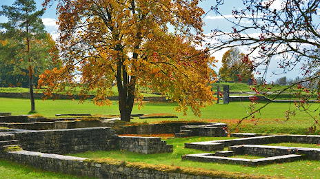
Römerkastell Abusina on the map, Kelheim, Germany
Photo
Where is located Römerkastell Abusina
Römerkastell Abusina — local attraction, which is located at Abusinastraße 1, 93333 Neustadt an der Donau, Germany and belongs to the category — historical landmark. Average visitor rating for this place — 4.5 (according to 327 ratings, information from open sources and relevant for 2022).
Exact location — Römerkastell Abusina, marked on the map with a red marker.
You can get directions to Römerkastell Abusina on the map from your location.
What else is interesting in Kelheim? You can see all the sights if you go to the city page.
Coordinates
Römerkastell Abusina, Germany coordinates in decimal format: latitude — 48.85147848287162, longitude — 11.771381098199036. When converted to degrees, minutes, seconds Römerkastell Abusina has the following coordinates: 48°51′5.32 north latitude and 11°46′16.97 east longitude.
Nearby cities
The largest cities that are located nearby:
- Regensburg — 19 km
- Ingolstadt — 38 km
- Nuremberg — 83 km
- Fürth — 89 km
- Munich — 89 km
- Augsburg — 95 km
- Erlangen — 97 km
- Pilsen
 (Czech Republic) — 140 km
 - Salzburg
 (Austria) — 150 km
 - Ulm — 151 km
- Würzburg — 168 km
- Innsbruck (Austria) — 186 km
- Linz (Austria) — 189 km
- Heilbronn — 195 km
- Stuttgart — 198 km
- Reutlingen — 202 km
- Gera — 218 km
- Prague (Czech Republic) — 222 km
- Chemnitz — 223 km
Distance to the capital
Distance to the capital (Berlin) is about — 424 km.