
 Gilserberg
Berlin
Bordesholm
Bechtolsheim
Aub
Triptis
Heppenheim
Biblis
Angermünde
Gilserberg
Berlin
Bordesholm
Bechtolsheim
Aub
Triptis
Heppenheim
Biblis
Angermünde
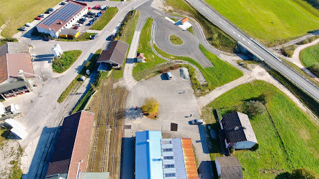
Ehem. Torfwerk Mühlreit on the map, Bad Reichenhall, Germany
Photo
Where is located Ehem. Torfwerk Mühlreit
Ehem. Torfwerk Mühlreit — local attraction, which is located at Mühlreit 3, 83404 Ainring, Germany and belongs to the category — local history museum. Average visitor rating for this place — 4.6 (according to 25 ratings, information from open sources and relevant for 2022).
Exact location — Ehem. Torfwerk Mühlreit, marked on the map with a red marker.
You can get directions to Ehem. Torfwerk Mühlreit on the map from your location.
What else is interesting in Bad Reichenhall? You can see all the sights if you go to the city page.
Coordinates
Ehem. Torfwerk Mühlreit, Germany coordinates in decimal format: latitude — 47.8344943692447, longitude — 12.92887099800495. When converted to degrees, minutes, seconds Ehem. Torfwerk Mühlreit has the following coordinates: 47°50′4.18 north latitude and 12°55′43.94 east longitude.
Nearby cities
The largest cities that are located nearby:
- Salzburg
 (Austria) — 16 km
 - Munich — 106 km
- Linz (Austria) — 121 km
- Innsbruck (Austria) — 122 km
- Regensburg — 153 km
- Ingolstadt — 156 km
- Augsburg — 162 km
- Graz (Austria) — 206 km
- Ljubljana
 (Slovenia) — 223 km
 - Pilsen
 (Czech Republic) — 225 km
 - Ulm — 225 km
- Trento
 (Italy) — 228 km
 - Nuremberg — 230 km
- Fürth — 236 km
- Trieste (Italy) — 240 km
- Erlangen — 245 km
- Venice (Italy) — 257 km
- Vienna (Austria) — 263 km
- Vicenza (Italy) — 263 km
Distance to the capital
Distance to the capital (Berlin) is about — 522 km.