
 Maureville
Samoëns
Gréning
Toulouse
Volx
Goudet
Méhoncourt
Saint-Hymer
Pontcarré
Maureville
Samoëns
Gréning
Toulouse
Volx
Goudet
Méhoncourt
Saint-Hymer
Pontcarré
Trainland on the map, Saint-Die-des-Vosges, France
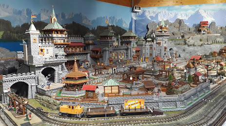
Photo
Where is located Trainland
Trainland — local attraction, which is located at 7-9 Rue du 12ème Régiment d'Artillerie, 88100 Saint-Dié-des-Vosges, France and belongs to the category — museum. Average visitor rating for this place — 4.4 (according to 205 ratings, information from open sources and relevant for 2022).
Exact location — Trainland, marked on the map with a red marker.
You can get directions to Trainland on the map from your location.
What else is interesting in Saint-Die-des-Vosges? You can see all the sights if you go to the city page.
Coordinates
Trainland, France coordinates in decimal format: latitude — 48.280839580119085, longitude — 6.967826598020563. When converted to degrees, minutes, seconds Trainland has the following coordinates: 48°16′51.02 north latitude and 6°58′4.18 east longitude.
Nearby cities
The largest cities that are located nearby:
- Mulhouse — 66 km
- Strasbourg — 67 km
- Nancy — 71 km
- Freiburg
 (Germany) — 73 km
 - Basel
 (Switzerland) — 93 km
 - Saarbrücken (Germany) — 105 km
- Metz — 108 km
- Karlsruhe (Germany) — 132 km
- Besançon — 135 km
- Pforzheim (Germany) — 144 km
- Bern (Switzerland) — 153 km
- Zurich (Switzerland) — 157 km
- Trier (Germany) — 163 km
- Reutlingen (Germany) — 167 km
- Ludwigshafen (Germany) — 170 km
- Stuttgart (Germany) — 172 km
- Mannheim (Germany) — 172 km
- Heidelberg (Germany) — 175 km
- Dijon — 178 km
Distance to the capital
Distance to the capital (Paris) is about — 346 km.