 Pointe-à-la-Croix
Sainte-Irène, Quebec
Marsoui
Hecla
Muskrat Dam
Wunnummin Lake
Sainte-Brigitte-de-Laval
Drayton
Mauricie
Pointe-à-la-Croix
Sainte-Irène, Quebec
Marsoui
Hecla
Muskrat Dam
Wunnummin Lake
Sainte-Brigitte-de-Laval
Drayton
Mauricie
Esther-Blondin Park on the map, Vaudreuil-Dorion, Canada
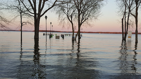
Photo
Where is located Esther-Blondin Park
Esther-Blondin Park — local attraction, which is located at Rue Ste Marguerite, Vaudreuil-Dorion, QC J7V 0H4, Canada and belongs to the category — park. Average visitor rating for this place — 4.5 (according to 103 ratings, information from open sources and relevant for 2022).
Exact location — Esther-Blondin Park, marked on the map with a red marker.
You can get directions to Esther-Blondin Park on the map from your location.
What else is interesting in Vaudreuil-Dorion? You can see all the sights if you go to the city page.
Coordinates
Esther-Blondin Park, Canada coordinates in decimal format: latitude — 45.400545809861356, longitude — -74.02336670191976. When converted to degrees, minutes, seconds Esther-Blondin Park has the following coordinates: 45°24′1.96 north latitude and -74°1′24.12 east longitude.
Nearby cities
The largest cities that are located nearby:
- Laval — 34 km
- Montreal — 38 km
- Longueuil — 43 km
- Gatineau — 129 km
- Trois-Rivières — 154 km
- Sherbrooke — 167 km
- Kingston — 233 km
- Levis — 258 km
- Quebec — 262 km
- Syracuse
 (United States) — 311 km
 - Manchester (United States) — 338 km
- Amherst (United States) — 361 km
- Lowell (United States) — 378 km
- Rochester (United States) — 380 km
- Springfield (United States) — 384 km
- Worcester (United States) — 393 km
- Saguenay — 399 km
- Cambridge (United States) — 412 km
- Boston (United States) — 415 km
Distance to the capital
Distance to the capital (Ottawa) is about — 131 km.