
 Maureville
Samoëns
Gréning
Toulouse
Volx
Goudet
Méhoncourt
Saint-Hymer
Pontcarré
Maureville
Samoëns
Gréning
Toulouse
Volx
Goudet
Méhoncourt
Saint-Hymer
Pontcarré
Touloubre (La Touloubre) on the map, Miramas, France
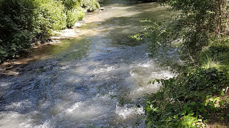
Photo
Where is located Touloubre (La Touloubre)
Touloubre (La Touloubre) — local attraction, which is located at 60 km and belongs to the category — -. Average visitor rating for this place — 4.2 (according to 38 ratings, information from open sources and relevant for 2022).
Exact location — Touloubre (La Touloubre), marked on the map with a red marker.
You can get directions to Touloubre (La Touloubre) on the map from your location.
What else is interesting in Miramas? You can see all the sights if you go to the city page.
Coordinates
Touloubre (La Touloubre), France coordinates in decimal format: latitude — 43.58996350954482, longitude — 5.014841010988805. When converted to degrees, minutes, seconds Touloubre (La Touloubre) has the following coordinates: 43°35′23.87 north latitude and 5°0′53.43 east longitude.
Nearby cities
The largest cities that are located nearby:
- Aix-en-Provence — 36 km
- Marseille — 44 km
- Nimes — 58 km
- Montpellier — 90 km
- Toulon — 91 km
- Nice — 181 km
- Grenoble — 186 km
- Perpignan — 198 km
- Saint-Étienne — 210 km
- Lyon — 241 km
- Villeurbanne — 242 km
- Turin
 (Italy) — 266 km
 - Clermont-Ferrand — 283 km
- Toulouse — 285 km
- Geneva
 (Switzerland) — 301 km
 - Mataró
 (Spain) — 310 km
 - Genoa (Italy) — 324 km
- Badalona (Spain) — 329 km
- Sabadell (Spain) — 329 km
Distance to the capital
Distance to the capital (Paris) is about — 620 km.