
 Puerto de la Duquesa
La Serna de Iguña
Pumalverde
Puentenansa
La Iglesia
Casar de Periedo
Fuengirola
Renedo de Piélagos
Villabanez
Puerto de la Duquesa
La Serna de Iguña
Pumalverde
Puentenansa
La Iglesia
Casar de Periedo
Fuengirola
Renedo de Piélagos
Villabanez
Lanzarote Golf on the map, Puerto del Carmen, Spain
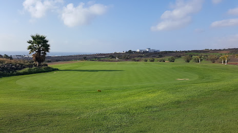
Photo
Where is located Lanzarote Golf
Lanzarote Golf — local attraction, which is located at Carretera del Puerto del Carmen Tías s/n, 35510 Puerto del Carmen, Las Palmas, Spain and belongs to the category — public golf course. Average visitor rating for this place — - (according to 116 ratings, information from open sources and relevant for 2022).
Exact location — Lanzarote Golf, marked on the map with a red marker.
You can get directions to Lanzarote Golf on the map from your location.
What else is interesting in Puerto del Carmen? You can see all the sights if you go to the city page.
Coordinates
Lanzarote Golf, Spain coordinates in decimal format: latitude — 28.937457231634863, longitude — -13.65244200238562. When converted to degrees, minutes, seconds Lanzarote Golf has the following coordinates: 28°56′14.85 north latitude and -13°39′8.79 east longitude.
Nearby cities
The largest cities that are located nearby:
- Las Palmas de Gran Canaria — 194 km
- Telde — 199 km
- Santa Cruz de Tenerife — 256 km
- Agadir
 (Morocco) — 422 km
 - Essaouira (Morocco) — 466 km
- Safi (Morocco) — 558 km
- Marrakesh (Morocco) — 611 km
- El Jadida (Morocco) — 675 km
- Ouarzazate (Morocco) — 676 km
- Azilal (Morocco) — 746 km
- Casablanca (Morocco) — 760 km
- Khouribga (Morocco) — 764 km
- Mohammedia (Morocco) — 782 km
- Temara (Morocco) — 831 km
- Sale (Morocco) — 848 km
- Khenifra (Morocco) — 865 km
- Kenitra (Morocco) — 875 km
- Khemisset (Morocco) — 883 km
- Meknes (Morocco) — 926 km
Distance to the capital
Distance to the capital (Madrid) is about — 1566 km.