
 Maureville
Samoëns
Gréning
Toulouse
Volx
Goudet
Méhoncourt
Saint-Hymer
Pontcarré
Maureville
Samoëns
Gréning
Toulouse
Volx
Goudet
Méhoncourt
Saint-Hymer
Pontcarré
Jardin botanique de Tours on the map, Saint-Cyr-sur-Loire, France
Photo
Where is located Jardin botanique de Tours
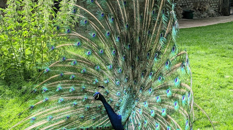
Jardin botanique de Tours — local attraction, which is located at 33 Bd Tonnellé, 37000 Tours, France and belongs to the category — botanical garden. Average visitor rating for this place — 4.5 (according to 4662 ratings, information from open sources and relevant for 2022).
Exact location — Jardin botanique de Tours, marked on the map with a red marker.
You can get directions to Jardin botanique de Tours on the map from your location.
What else is interesting in Saint-Cyr-sur-Loire? You can see all the sights if you go to the city page.
Coordinates
Jardin botanique de Tours, France coordinates in decimal format: latitude — 47.31568443917739, longitude — 0.7844079970564372. When converted to degrees, minutes, seconds Jardin botanique de Tours has the following coordinates: 47°18′56.46 north latitude and 0°47′3.87 east longitude.
Nearby cities
The largest cities that are located nearby:
- Tours — 2 km
- Le Mans — 75 km
- Angers — 92 km
- Orléans — 108 km
- Nantes — 168 km
- Limoges — 179 km
- Rennes — 190 km
- Boulogne-Billancourt — 196 km
- Caen — 211 km
- Rouen — 228 km
- Le Havre — 235 km
- Clermont-Ferrand — 259 km
- Amiens — 299 km
- Bordeaux — 300 km
- Reims — 318 km
- Dijon — 328 km
- Saint-Étienne — 361 km
- Lyon — 369 km
- Villeurbanne — 372 km
Distance to the capital
Distance to the capital (Paris) is about — 207 km.