
 Litoral Del Bajo San Juan
El Cantón de San Pablo
Juan Frío
Santa Barbara
El Juncal
Dibulla
Vereda Campo Alegre
San Pablo
Guaramito
Litoral Del Bajo San Juan
El Cantón de San Pablo
Juan Frío
Santa Barbara
El Juncal
Dibulla
Vereda Campo Alegre
San Pablo
Guaramito
Américas Park on the map, Magangué, Colombia
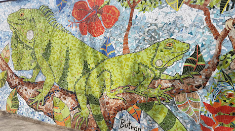
Photo
Where is located Américas Park
Américas Park — local attraction, which is located at Avenida Diego de Carvajal, Magangué, Bolívar, Colombia and belongs to the category — park. Average visitor rating for this place — 3.8 (according to 972 ratings, information from open sources and relevant for 2022).
Exact location — Américas Park, marked on the map with a red marker.
You can get directions to Américas Park on the map from your location.
What else is interesting in Magangué? You can see all the sights if you go to the city page.
Coordinates
Américas Park, Colombia coordinates in decimal format: latitude — 9.23580784463723, longitude — -74.74572750284531. When converted to degrees, minutes, seconds Américas Park has the following coordinates: 9°14′8.91 north latitude and -74°44′44.62 east longitude.
Nearby cities
The largest cities that are located nearby:
- Sincelejo — 71 km
- Monteria — 135 km
- Cartagena — 155 km
- Malambo — 179 km
- Soledad — 185 km
- Barranquilla — 191 km
- Valledupar — 213 km
- Santa Marta — 229 km
- Barrancabermeja — 261 km
- Cúcuta — 288 km
- Bucaramanga — 294 km
- Giron — 296 km
- Floridablanca — 302 km
- San Cristobal
 (Venezuela) — 321 km
 - Bello — 333 km
- Medellín — 341 km
- Envigado — 352 km
- Itagüi — 353 km
- Maicao — 361 km
Distance to the capital
Distance to the capital (Bogota) is about — 521 km.