
 Maureville
Samoëns
Gréning
Toulouse
Volx
Goudet
Méhoncourt
Saint-Hymer
Pontcarré
Maureville
Samoëns
Gréning
Toulouse
Volx
Goudet
Méhoncourt
Saint-Hymer
Pontcarré
Thérain on the map, Montataire, France
Photo
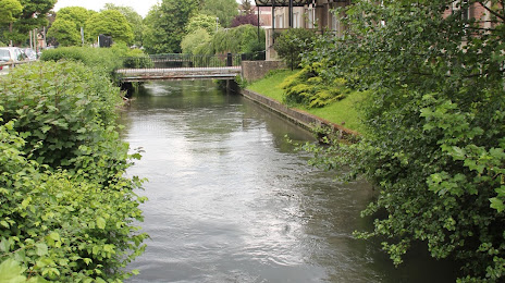
Where is located Thérain
Thérain — local attraction, which is located at 94 km and belongs to the category — -. Average visitor rating for this place — 5.0 (according to 1 rating, information from open sources and relevant for 2022).
Exact location — Thérain, marked on the map with a red marker.
You can get directions to Thérain on the map from your location.
What else is interesting in Montataire? You can see all the sights if you go to the city page.
Coordinates
Thérain, France coordinates in decimal format: latitude — 49.26233058309103, longitude — 2.430097949124159. When converted to degrees, minutes, seconds Thérain has the following coordinates: 49°15′44.39 north latitude and 2°25′48.35 east longitude.
Nearby cities
The largest cities that are located nearby:
- Boulogne-Billancourt — 48 km
- Amiens — 71 km
- Rouen — 98 km
- Reims — 115 km
- Orléans — 155 km
- Lille — 158 km
- Le Havre — 169 km
- Charleroi
 (Belgium) — 191 km
 - Caen — 203 km
- Le Mans — 216 km
- Namur (Belgium) — 217 km
- Brussels (Belgium) — 221 km
- Eastbourne
 (United Kingdom) — 224 km
 - Tours — 244 km
- Antwerp (Belgium) — 256 km
- Liège (Belgium) — 268 km
- Gillingham (United Kingdom) — 269 km
- Metz — 271 km
- Crawley (United Kingdom) — 274 km
Distance to the capital
Distance to the capital (Paris) is about — 45 km.