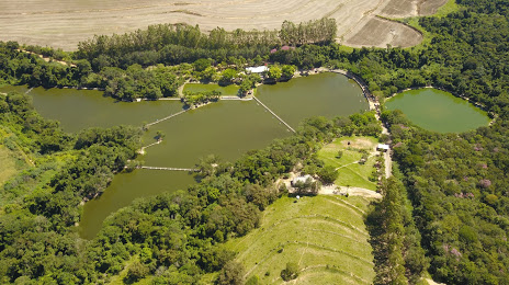
Nobres — Cerqueira César
Nobres — São Leopoldo
Nobres — Feira Grande
Nobres — Maringa
Nobres — Apodi
Nobres — Canarana
Nobres — State of Rondônia
Nobres — São Francisco do Sul
Nobres — Cristiano Otoni
Nobres — Bairro Novo
Nobres — Frei Miguelinho
Nobres — Taipas
Nobres — Cajobi
Nobres — Americano do Brasil
Nobres — São Domingos de Pombal
Nobres — Porto Seguro
Nobres — Rafard
Nobres — Pareci Novo
Nobres — Itá
Cuiaba
Jaciara
Rondonópolis
Alto Araguaia
Santa Rita do Araguaia
Cassilândia
Paranaíba
Santa Clara D'Oeste
Santa Fé do Sul
Urânia
Jales
Estrela D'Oeste
Valentim Gentil
Cosmorama
Tanabi
Mirassol
Sao Jose de Rio Preto
Cedral
Uchoa
Catanduva
Pindorama
Santa Adélia
Matão
Ibaté
São Carlos
Itirapina
São Paulo
Rio Claro
Santa Gertrudes
Iracemápolis
Piracicaba
Rio das Pedras
Rio das Pedras
Capivari
Rafard
Nobres — Porto Feliz distance, route on the map
Distance by car
Distance between Nobres, Mato Grosso, Brazil and Porto Feliz, São Paulo, Brazil by car is — km, or miles. To travel this distance by car, you need minute, or h.
Route on the map, driving directions
Car route Nobres — Porto Feliz was created automatically. The road on the map is shown as a blue line. By moving the markers, you can create a new route through the points you need.
Passing cities through which the car route passes: Rosário Oeste, Cuiaba, Jaciara, Rondonópolis, Alto Araguaia, Santa Rita do Araguaia, Cassilândia, Paranaíba, Santa Clara D'Oeste, Santa Fé do Sul, Urânia, Jales, Estrela D'Oeste, Valentim Gentil, Cosmorama, Tanabi, Mirassol, Sao Jose de Rio Preto, Cedral, Uchoa, Catanduva, Pindorama, Santa Adélia, Matão, Ibaté, São Carlos, Itirapina, São Paulo, Rio Claro, Santa Gertrudes, Iracemápolis, Piracicaba, Rio das Pedras, Rio das Pedras, Capivari, Rafard.
Distance by plane
If you decide to take a trip Nobres Porto Feliz by plane, then you have to fly the distance — 1322 km or 820 miles. It is marked on the map with a gray line (between two points in a straight line).
Flight time
Estimated flight time Nobres Porto Feliz by plane at cruising speed 750 km / h will be — 1 h. and 45 min.
Direction of movement
Brazil, Nobres — right-hand traffic. Brazil, Porto Feliz — right-hand traffic.
Difference in time
Nobres and Porto Feliz are in different time zones. The time difference is 1 hour (UTC -4 America/Campo_Grande, UTC -3 America/Sao_Paulo).
Interesting Facts
Information on alternative ways to get to your destination.
The length of this distance is about 3.3% of the total length of the equator.
The percentage of the population is clearly shown in the graph:
Nobres — 12,010 (less by 29,006), Porto Feliz — 41,016 residents.
The cost of travel
Calculate the cost of the trip yourself using the fuel consumption calculator, changing the data in the table.