
 Puerto de la Duquesa
La Serna de Iguña
Pumalverde
Puentenansa
La Iglesia
Casar de Periedo
Fuengirola
Renedo de Piélagos
Villabanez
Puerto de la Duquesa
La Serna de Iguña
Pumalverde
Puentenansa
La Iglesia
Casar de Periedo
Fuengirola
Renedo de Piélagos
Villabanez
Centro histórico de Córdoba on the map, Córdoba, Spain
Photo
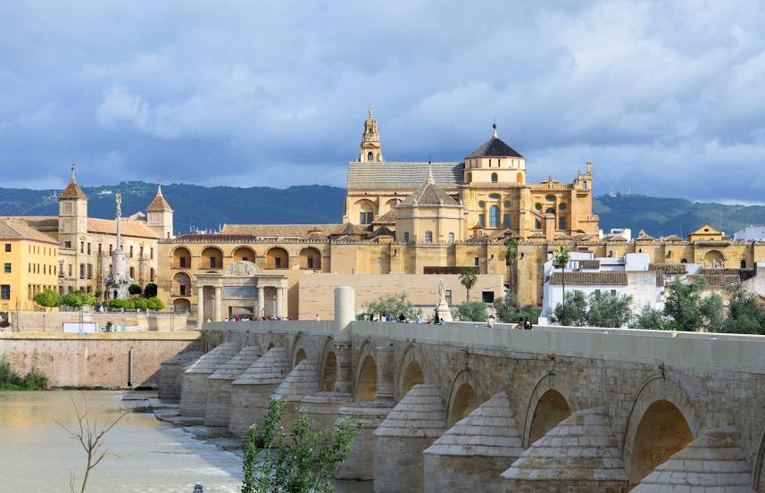
Where is located Centro histórico de Córdoba
Centro histórico de Córdoba — local attraction, which is located at C. Cardenal Herrero, 1, 14003 Córdoba, Spain and belongs to the category — historical place. Average visitor rating for this place — 4.9 (according to 18 ratings, information from open sources and relevant for 2022).
Exact location — Centro histórico de Córdoba, marked on the map with a red marker.
You can get directions to Centro histórico de Córdoba on the map from your location.
What else is interesting in Córdoba? You can see all the sights if you go to the city page.
Coordinates
Centro histórico de Córdoba, Spain coordinates in decimal format: latitude — 37.87947108716249, longitude — -4.781892585626117. When converted to degrees, minutes, seconds Centro histórico de Córdoba has the following coordinates: 37°52′46.1 north latitude and -4°46′54.81 east longitude.
Nearby cities
The largest cities that are located nearby:
- Jaén — 88 km
- Dos Hermanas — 121 km
- Granada — 130 km
- Málaga — 133 km
- Marbella — 153 km
- Jerez — 179 km
- Cádiz — 202 km
- Algeciras — 202 km
- Huelva — 203 km
- Badajoz — 218 km
- Almería — 236 km
- Tangier
 (Morocco) — 254 km
 - Tetouan (Morocco) — 262 km
- Fuenlabrada — 278 km
- Albacete — 279 km
- Móstoles — 280 km
- Getafe — 282 km
- Leganés — 283 km
- Alcorcón — 283 km
Distance to the capital
Distance to the capital (Madrid) is about — 297 km.