
 Gilserberg
Berlin
Bordesholm
Bechtolsheim
Aub
Triptis
Heppenheim
Biblis
Angermünde
Gilserberg
Berlin
Bordesholm
Bechtolsheim
Aub
Triptis
Heppenheim
Biblis
Angermünde
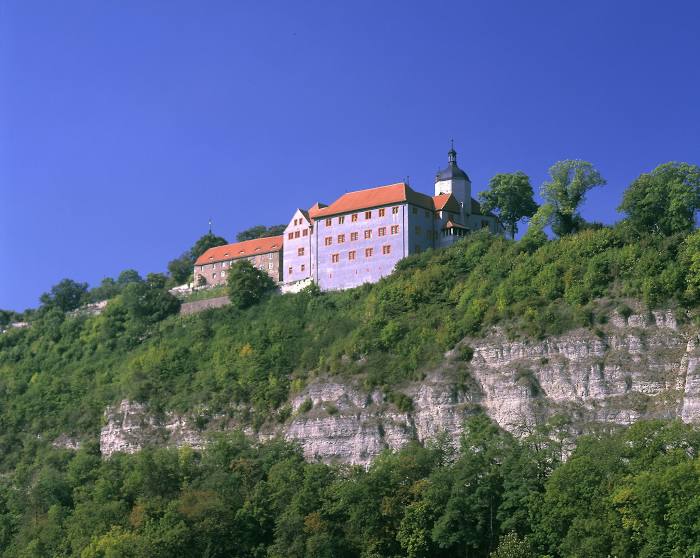
Dornburger Schlösser, Rokoko-Schloss on the map, Jena, Germany
Photo
Where is located Dornburger Schlösser, Rokoko-Schloss
Dornburger Schlösser, Rokoko-Schloss — local attraction, which is located at Max-Krehan-Straße 5, 07774, Germany and belongs to the category — historical landmark. Average visitor rating for this place — 4.7 (according to 272 ratings, information from open sources and relevant for 2022).
Exact location — Dornburger Schlösser, Rokoko-Schloss, marked on the map with a red marker.
You can get directions to Dornburger Schlösser, Rokoko-Schloss on the map from your location.
What else is interesting in Jena? You can see all the sights if you go to the city page.
Coordinates
Dornburger Schlösser, Rokoko-Schloss, Germany coordinates in decimal format: latitude — 51.00584335925661, longitude — 11.66820535974093. When converted to degrees, minutes, seconds Dornburger Schlösser, Rokoko-Schloss has the following coordinates: 51°0′21.04 north latitude and 11°40′5.54 east longitude.
Nearby cities
The largest cities that are located nearby:
- Gera — 35 km
- Erfurt — 39 km
- Leipzig — 71 km
- Chemnitz — 94 km
- Magdeburg — 132 km
- Göttingen — 134 km
- Dresden — 150 km
- Kassel — 152 km
- Erlangen — 154 km
- Salzgitter — 160 km
- Brunswick — 165 km
- Fürth — 166 km
- Nuremberg — 167 km
- Würzburg — 171 km
- Wolfsburg — 174 km
- Hildesheim — 175 km
- Pilsen
 (Czech Republic) — 183 km
 - Potsdam — 190 km
- Hanover — 203 km
Distance to the capital
Distance to the capital (Berlin) is about — 207 km.