
 Gilserberg
Berlin
Bordesholm
Bechtolsheim
Aub
Triptis
Heppenheim
Biblis
Angermünde
Gilserberg
Berlin
Bordesholm
Bechtolsheim
Aub
Triptis
Heppenheim
Biblis
Angermünde
Verna-Park on the map, Wiesbaden, Germany
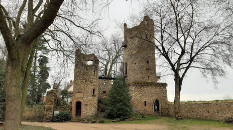
Photo
Where is located Verna-Park
Verna-Park — local attraction, which is located at 65428 Rüsselsheim, Germany and belongs to the category — park. Average visitor rating for this place — 4.5 (according to 312 ratings, information from open sources and relevant for 2022).
Exact location — Verna-Park, marked on the map with a red marker.
You can get directions to Verna-Park on the map from your location.
What else is interesting in Wiesbaden? You can see all the sights if you go to the city page.
Coordinates
Verna-Park, Germany coordinates in decimal format: latitude — 50.0423750740803, longitude — 8.408371565944027. When converted to degrees, minutes, seconds Verna-Park has the following coordinates: 50°2′32.55 north latitude and 8°24′30.14 east longitude.
Nearby cities
The largest cities that are located nearby:
- Mainz — 9 km
- Frankfurt — 32 km
- Darmstadt — 37 km
- Offenbach — 38 km
- Koblenz — 55 km
- Mannheim — 67 km
- Ludwigshafen — 68 km
- Heidelberg — 81 km
- Siegen — 90 km
- Bonn — 108 km
- Karlsruhe — 119 km
- Trier — 120 km
- Heilbronn — 125 km
- Würzburg — 126 km
- Bergisch Gladbach — 127 km
- Saarbrücken — 129 km
- Cologne — 130 km
- Pforzheim — 135 km
- Remscheid — 142 km
Distance to the capital
Distance to the capital (Berlin) is about — 443 km.