
 Gilserberg
Berlin
Bordesholm
Bechtolsheim
Aub
Triptis
Heppenheim
Biblis
Angermünde
Gilserberg
Berlin
Bordesholm
Bechtolsheim
Aub
Triptis
Heppenheim
Biblis
Angermünde
Saurier-Erlebnispfad on the map, Gotha, Germany
Photo
Where is located Saurier-Erlebnispfad
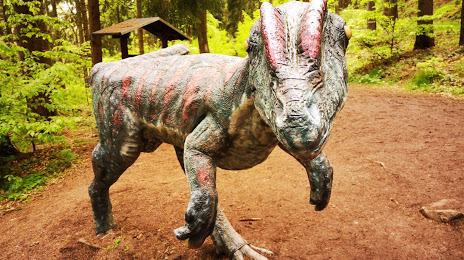
Saurier-Erlebnispfad — local attraction, which is located at Gartenstraße, 99887 Georgenthal/Thüringer Wald, Germany and belongs to the category — theme park. Average visitor rating for this place — 4.2 (according to 270 ratings, information from open sources and relevant for 2022).
Exact location — Saurier-Erlebnispfad, marked on the map with a red marker.
You can get directions to Saurier-Erlebnispfad on the map from your location.
What else is interesting in Gotha? You can see all the sights if you go to the city page.
Coordinates
Saurier-Erlebnispfad, Germany coordinates in decimal format: latitude — 50.82844784353192, longitude — 10.653738859734432. When converted to degrees, minutes, seconds Saurier-Erlebnispfad has the following coordinates: 50°49′42.41 north latitude and 10°39′13.46 east longitude.
Nearby cities
The largest cities that are located nearby:
- Erfurt — 23 km
- Göttingen — 85 km
- Kassel — 94 km
- Gera — 96 km
- Leipzig — 123 km
- Salzgitter — 135 km
- Würzburg — 139 km
- Hildesheim — 143 km
- Magdeburg — 144 km
- Brunswick — 147 km
- Erlangen — 152 km
- Chemnitz — 155 km
- Paderborn — 159 km
- Wolfsburg — 163 km
- Fürth — 164 km
- Offenbach — 166 km
- Nuremberg — 167 km
- Frankfurt — 171 km
- Hanover — 171 km
Distance to the capital
Distance to the capital (Berlin) is about — 267 km.