
 Gilserberg
Berlin
Bordesholm
Bechtolsheim
Aub
Triptis
Heppenheim
Biblis
Angermünde
Gilserberg
Berlin
Bordesholm
Bechtolsheim
Aub
Triptis
Heppenheim
Biblis
Angermünde
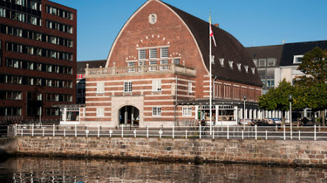
Kieler Stadt- und Schifffahrtsmuseum on the map, Kiel, Germany
Photo
Where is located Kieler Stadt- und Schifffahrtsmuseum
Kieler Stadt- und Schifffahrtsmuseum — local attraction, which is located at Dänische Str. 19, 24103 Kiel, Germany and belongs to the category — museum. Average visitor rating for this place — 4.4 (according to 22 ratings, information from open sources and relevant for 2022).
Exact location — Kieler Stadt- und Schifffahrtsmuseum, marked on the map with a red marker.
You can get directions to Kieler Stadt- und Schifffahrtsmuseum on the map from your location.
What else is interesting in Kiel? You can see all the sights if you go to the city page.
Coordinates
Kieler Stadt- und Schifffahrtsmuseum, Germany coordinates in decimal format: latitude — 54.32430483995839, longitude — 10.141498959864915. When converted to degrees, minutes, seconds Kieler Stadt- und Schifffahrtsmuseum has the following coordinates: 54°19′27.5 north latitude and 10°8′29.4 east longitude.
Nearby cities
The largest cities that are located nearby:
- Odense
 (Denmark) — 121 km
 - Rostock — 131 km
- Bremerhaven — 133 km
- Bremen — 163 km
- Aarhus (Denmark) — 203 km
- Copenhagen (Denmark) — 214 km
- Wolfsburg — 215 km
- Hanover — 217 km
- Brunswick — 229 km
- Malmö
 (Sweden) — 229 km
 - Hildesheim — 240 km
- Salzgitter — 241 km
- Magdeburg — 264 km
- Groningen
 (Netherlands) — 265 km
 - Osnabrück — 266 km
- Emmen (Netherlands) — 275 km
- Bielefeld — 276 km
- Potsdam — 292 km
- Berlin — 299 km
Distance to the capital
Distance to the capital (Berlin) is about — 295 km.