
 Gilserberg
Berlin
Bordesholm
Bechtolsheim
Aub
Triptis
Heppenheim
Biblis
Angermünde
Gilserberg
Berlin
Bordesholm
Bechtolsheim
Aub
Triptis
Heppenheim
Biblis
Angermünde
Feuerwehrmuseum Schleswig-Holstein on the map, Norderstedt, Germany
Photo
Where is located Feuerwehrmuseum Schleswig-Holstein
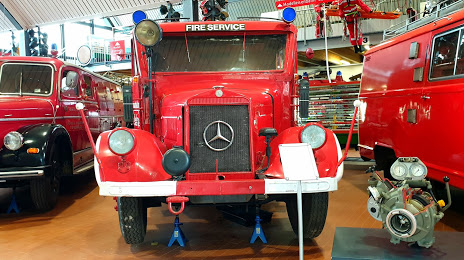
Feuerwehrmuseum Schleswig-Holstein — local attraction, which is located at Friedrichsgaber Weg 290, 22846 Norderstedt, Germany and belongs to the category — museum. Average visitor rating for this place — 4.5 (according to 426 ratings, information from open sources and relevant for 2022).
Exact location — Feuerwehrmuseum Schleswig-Holstein, marked on the map with a red marker.
You can get directions to Feuerwehrmuseum Schleswig-Holstein on the map from your location.
What else is interesting in Norderstedt? You can see all the sights if you go to the city page.
Coordinates
Feuerwehrmuseum Schleswig-Holstein, Germany coordinates in decimal format: latitude — 53.702505555565146, longitude — 9.98003915984126. When converted to degrees, minutes, seconds Feuerwehrmuseum Schleswig-Holstein has the following coordinates: 53°42′9.02 north latitude and 9°58′48.14 east longitude.
Nearby cities
The largest cities that are located nearby:
- Kiel — 69 km
- Bremerhaven — 95 km
- Bremen — 105 km
- Rostock — 143 km
- Hanover — 147 km
- Wolfsburg — 151 km
- Brunswick — 162 km
- Hildesheim — 171 km
- Salzgitter — 173 km
- Odense
 (Denmark) — 190 km
 - Osnabrück — 205 km
- Magdeburg — 207 km
- Bielefeld — 210 km
- Emmen
 (Netherlands) — 231 km
 - Groningen (Netherlands) — 233 km
- Paderborn — 235 km
- Göttingen — 239 km
- Münster — 251 km
- Potsdam — 252 km
Distance to the capital
Distance to the capital (Berlin) is about — 264 km.