
 Gilserberg
Berlin
Bordesholm
Bechtolsheim
Aub
Triptis
Heppenheim
Biblis
Angermünde
Gilserberg
Berlin
Bordesholm
Bechtolsheim
Aub
Triptis
Heppenheim
Biblis
Angermünde
Münchner Wald - Kletterwald Vaterstetten on the map, Haar, Germany
Photo
Where is located Münchner Wald - Kletterwald Vaterstetten
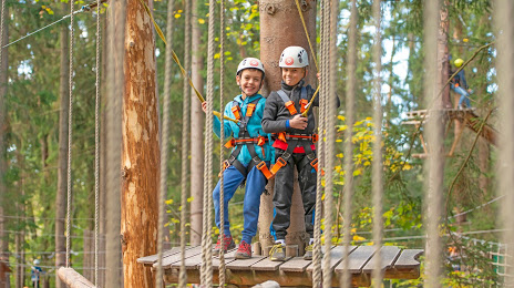
Münchner Wald - Kletterwald Vaterstetten — local attraction, which is located at Ottendichler Str. 1, 85591 Vaterstetten, Germany and belongs to the category — high ropes course. Average visitor rating for this place — 4.4 (according to 872 ratings, information from open sources and relevant for 2022).
Exact location — Münchner Wald - Kletterwald Vaterstetten, marked on the map with a red marker.
You can get directions to Münchner Wald - Kletterwald Vaterstetten on the map from your location.
What else is interesting in Haar? You can see all the sights if you go to the city page.
Coordinates
Münchner Wald - Kletterwald Vaterstetten, Germany coordinates in decimal format: latitude — 48.11856342985749, longitude — 11.761648259637697. When converted to degrees, minutes, seconds Münchner Wald - Kletterwald Vaterstetten has the following coordinates: 48°7′6.83 north latitude and 11°45′41.93 east longitude.
Nearby cities
The largest cities that are located nearby:
- Munich — 11 km
- Augsburg — 68 km
- Ingolstadt — 76 km
- Innsbruck
 (Austria) — 96 km
 - Regensburg — 103 km
- Salzburg (Austria) — 104 km
- Ulm — 132 km
- Nuremberg — 156 km
- Fürth — 160 km
- Erlangen — 172 km
- Linz (Austria) — 189 km
- Reutlingen — 190 km
- Stuttgart — 200 km
- Pilsen
 (Czech Republic) — 215 km
 - Heilbronn — 215 km
- Würzburg — 225 km
- Trento
 (Italy) — 230 km
 - Pforzheim — 237 km
- Zurich
 (Switzerland) — 253 km
Distance to the capital
Distance to the capital (Berlin) is about — 503 km.