
 Gilserberg
Berlin
Bordesholm
Bechtolsheim
Aub
Triptis
Heppenheim
Biblis
Angermünde
Gilserberg
Berlin
Bordesholm
Bechtolsheim
Aub
Triptis
Heppenheim
Biblis
Angermünde
Raichberg on the map, Hechingen, Germany
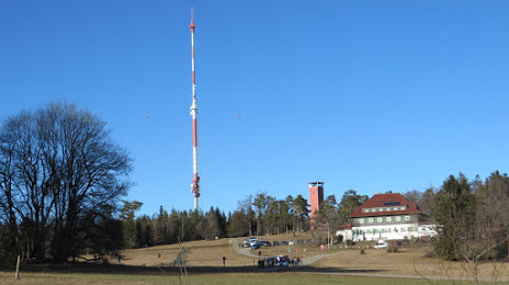
Photo
Where is located Raichberg
Raichberg — local attraction, which is located at 956 m and belongs to the category — -. Average visitor rating for this place — 4.8 (according to 18 ratings, information from open sources and relevant for 2022).
Exact location — Raichberg, marked on the map with a red marker.
You can get directions to Raichberg on the map from your location.
What else is interesting in Hechingen? You can see all the sights if you go to the city page.
Coordinates
Raichberg, Germany coordinates in decimal format: latitude — 48.304411889068675, longitude — 8.994150977132112. When converted to degrees, minutes, seconds Raichberg has the following coordinates: 48°18′15.88 north latitude and 8°59′38.94 east longitude.
Nearby cities
The largest cities that are located nearby:
- Reutlingen — 25 km
- Stuttgart — 49 km
- Pforzheim — 63 km
- Ulm — 76 km
- Karlsruhe — 83 km
- Heilbronn — 89 km
- Freiburg — 92 km
- Strasbourg
 (France) — 92 km
 - Zurich
 (Switzerland) — 113 km
 - Heidelberg — 117 km
- Ludwigshafen — 130 km
- Mannheim — 130 km
- Basel (Switzerland) — 134 km
- Mulhouse (France) — 138 km
- Augsburg — 142 km
- Darmstadt — 169 km
- Saarbrücken — 172 km
- Würzburg — 174 km
- Ingolstadt — 185 km
Distance to the capital
Distance to the capital (Berlin) is about — 563 km.