
 Gilserberg
Berlin
Bordesholm
Bechtolsheim
Aub
Triptis
Heppenheim
Biblis
Angermünde
Gilserberg
Berlin
Bordesholm
Bechtolsheim
Aub
Triptis
Heppenheim
Biblis
Angermünde
Geroldsauer Wasserfall on the map, Baden-Baden, Germany
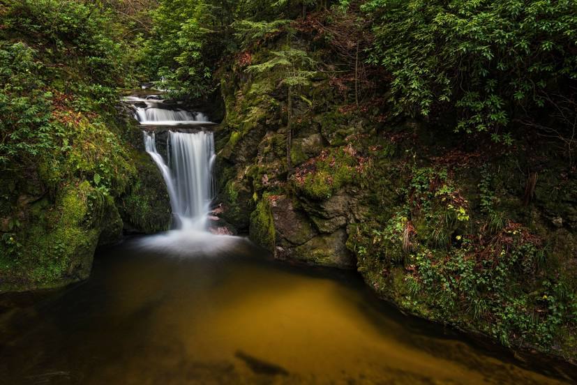
Photo
Where is located Geroldsauer Wasserfall
Geroldsauer Wasserfall — local attraction, which is located at Wasserfallstraße, 76534 Baden-Baden, Germany and belongs to the category — waterfall. Average visitor rating for this place — 4.6 (according to 1615 ratings, information from open sources and relevant for 2022).
Exact location — Geroldsauer Wasserfall, marked on the map with a red marker.
You can get directions to Geroldsauer Wasserfall on the map from your location.
What else is interesting in Baden-Baden? You can see all the sights if you go to the city page.
Coordinates
Geroldsauer Wasserfall, Germany coordinates in decimal format: latitude — 48.71166199129584, longitude — 8.24934065965853. When converted to degrees, minutes, seconds Geroldsauer Wasserfall has the following coordinates: 48°42′41.98 north latitude and 8°14′57.63 east longitude.
Nearby cities
The largest cities that are located nearby:
- Karlsruhe — 30 km
- Pforzheim — 37 km
- Strasbourg
 (France) — 41 km
 - Stuttgart — 70 km
- Heidelberg — 77 km
- Reutlingen — 77 km
- Ludwigshafen — 80 km
- Mannheim — 82 km
- Heilbronn — 82 km
- Freiburg — 89 km
- Saarbrücken — 103 km
- Darmstadt — 126 km
- Mulhouse (France) — 130 km
- Ulm — 135 km
- Mainz — 136 km
- Basel
 (Switzerland) — 141 km
 - Wiesbaden — 145 km
- Nancy (France) — 149 km
- Offenbach — 152 km
Distance to the capital
Distance to the capital (Berlin) is about — 558 km.