
 Gilserberg
Berlin
Bordesholm
Bechtolsheim
Aub
Triptis
Heppenheim
Biblis
Angermünde
Gilserberg
Berlin
Bordesholm
Bechtolsheim
Aub
Triptis
Heppenheim
Biblis
Angermünde
Landschaftspark Ottobrunn on the map, Taufkirchen, Germany
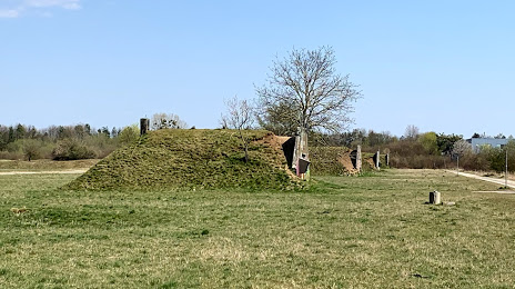
Photo
Where is located Landschaftspark Ottobrunn
Landschaftspark Ottobrunn — local attraction, which is located at Unnamed Road, 82008 Unterhaching, Germany and belongs to the category — park. Average visitor rating for this place — 4.7 (according to 9 ratings, information from open sources and relevant for 2022).
Exact location — Landschaftspark Ottobrunn, marked on the map with a red marker.
You can get directions to Landschaftspark Ottobrunn on the map from your location.
What else is interesting in Taufkirchen? You can see all the sights if you go to the city page.
Coordinates
Landschaftspark Ottobrunn, Germany coordinates in decimal format: latitude — 48.06721738674232, longitude — 11.64810555963586. When converted to degrees, minutes, seconds Landschaftspark Ottobrunn has the following coordinates: 48°4′1.98 north latitude and 11°38′53.18 east longitude.
Nearby cities
The largest cities that are located nearby:
- Munich — 10 km
- Augsburg — 64 km
- Ingolstadt — 80 km
- Innsbruck
 (Austria) — 88 km
 - Salzburg (Austria) — 110 km
- Regensburg — 112 km
- Ulm — 126 km
- Nuremberg — 160 km
- Fürth — 164 km
- Erlangen — 176 km
- Reutlingen — 184 km
- Stuttgart — 195 km
- Linz (Austria) — 198 km
- Heilbronn — 212 km
- Trento
 (Italy) — 222 km
 - Pilsen
 (Czech Republic) — 225 km
 - Würzburg — 226 km
- Pforzheim — 232 km
- Zurich
 (Switzerland) — 242 km
Distance to the capital
Distance to the capital (Berlin) is about — 511 km.