
 Gilserberg
Berlin
Bordesholm
Bechtolsheim
Aub
Triptis
Heppenheim
Biblis
Angermünde
Gilserberg
Berlin
Bordesholm
Bechtolsheim
Aub
Triptis
Heppenheim
Biblis
Angermünde
Landschaftspark Eigenerbach-Schlammteich on the map, Velbert, Germany
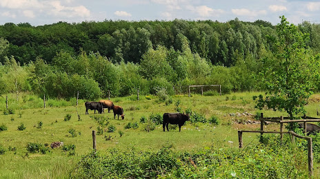
Photo
Where is located Landschaftspark Eigenerbach-Schlammteich
Landschaftspark Eigenerbach-Schlammteich — local attraction, which is located at 42553 Velbert, Germany and belongs to the category — state park. Average visitor rating for this place — 4.6 (according to 176 ratings, information from open sources and relevant for 2022).
Exact location — Landschaftspark Eigenerbach-Schlammteich, marked on the map with a red marker.
You can get directions to Landschaftspark Eigenerbach-Schlammteich on the map from your location.
What else is interesting in Velbert? You can see all the sights if you go to the city page.
Coordinates
Landschaftspark Eigenerbach-Schlammteich, Germany coordinates in decimal format: latitude — 51.313279356099336, longitude — 7.053520359752171. When converted to degrees, minutes, seconds Landschaftspark Eigenerbach-Schlammteich has the following coordinates: 51°18′47.81 north latitude and 7°3′12.67 east longitude.
Nearby cities
The largest cities that are located nearby:
- Wuppertal — 12 km
- Essen — 13 km
- Mülheim — 14 km
- Solingen — 19 km
- Bochum — 20 km
- Gelsenkirchen — 20 km
- Remscheid — 20 km
- Oberhausen — 21 km
- Duisburg — 22 km
- Düsseldorf — 22 km
- Bottrop — 22 km
- Witten — 24 km
- Herne — 25 km
- Neuss — 29 km
- Hagen — 29 km
- Moers — 30 km
- Krefeld — 32 km
- Recklinghausen — 32 km
- Dortmund — 35 km
Distance to the capital
Distance to the capital (Berlin) is about — 456 km.