
 Gilserberg
Berlin
Bordesholm
Bechtolsheim
Aub
Triptis
Heppenheim
Biblis
Angermünde
Gilserberg
Berlin
Bordesholm
Bechtolsheim
Aub
Triptis
Heppenheim
Biblis
Angermünde
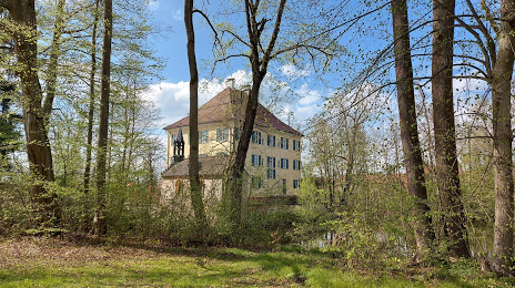
Schloss Unterwittelsbach Sisi-Schloss on the map, Aichach, Germany
Photo
Where is located Schloss Unterwittelsbach Sisi-Schloss
Schloss Unterwittelsbach Sisi-Schloss — local attraction, which is located at Klausenweg 1, 86551 Aichach, Germany and belongs to the category — castle. Average visitor rating for this place — 4.2 (according to 602 ratings, information from open sources and relevant for 2022).
Exact location — Schloss Unterwittelsbach Sisi-Schloss, marked on the map with a red marker.
You can get directions to Schloss Unterwittelsbach Sisi-Schloss on the map from your location.
What else is interesting in Aichach? You can see all the sights if you go to the city page.
Coordinates
Schloss Unterwittelsbach Sisi-Schloss, Germany coordinates in decimal format: latitude — 48.472257718819, longitude — 11.15595165965012. When converted to degrees, minutes, seconds Schloss Unterwittelsbach Sisi-Schloss has the following coordinates: 48°28′20.13 north latitude and 11°9′21.43 east longitude.
Nearby cities
The largest cities that are located nearby:
- Augsburg — 20 km
- Ingolstadt — 40 km
- Munich — 49 km
- Ulm — 85 km
- Regensburg — 93 km
- Nuremberg — 110 km
- Fürth — 113 km
- Erlangen — 125 km
- Innsbruck
 (Austria) — 133 km
 - Reutlingen — 142 km
- Stuttgart — 147 km
- Heilbronn — 159 km
- Salzburg (Austria) — 160 km
- Würzburg — 170 km
- Pforzheim — 184 km
- Heidelberg — 206 km
- Karlsruhe — 207 km
- Pilsen
 (Czech Republic) — 214 km
 - Mannheim — 223 km
Distance to the capital
Distance to the capital (Berlin) is about — 477 km.