
 Gilserberg
Berlin
Bordesholm
Bechtolsheim
Aub
Triptis
Heppenheim
Biblis
Angermünde
Gilserberg
Berlin
Bordesholm
Bechtolsheim
Aub
Triptis
Heppenheim
Biblis
Angermünde
Niedtal-Radweg on the map, Saarlouis, Germany
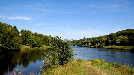
Photo
Where is located Niedtal-Radweg
Niedtal-Radweg — local attraction, which is located at 66780 Rehlingen-Siersburg, Germany and belongs to the category — tourist attraction. Average visitor rating for this place — 4.5 (according to 33 ratings, information from open sources and relevant for 2022).
Exact location — Niedtal-Radweg, marked on the map with a red marker.
You can get directions to Niedtal-Radweg on the map from your location.
What else is interesting in Saarlouis? You can see all the sights if you go to the city page.
Coordinates
Niedtal-Radweg, Germany coordinates in decimal format: latitude — 49.38463219485223, longitude — 6.665962459682377. When converted to degrees, minutes, seconds Niedtal-Radweg has the following coordinates: 49°23′4.68 north latitude and 6°39′57.46 east longitude.
Nearby cities
The largest cities that are located nearby:
- Saarbrücken — 19 km
- Metz
 (France) — 47 km
 - Trier — 49 km
- Nancy (France) — 80 km
- Strasbourg (France) — 110 km
- Ludwigshafen — 123 km
- Karlsruhe — 124 km
- Mannheim — 125 km
- Koblenz — 130 km
- Mainz — 130 km
- Wiesbaden — 135 km
- Heidelberg — 138 km
- Pforzheim — 149 km
- Darmstadt — 149 km
- Bonn — 159 km
- Frankfurt — 163 km
- Freiburg — 166 km
- Liège
 (Belgium) — 167 km
 - Offenbach — 168 km
Distance to the capital
Distance to the capital (Berlin) is about — 587 km.