
 Torà
Anaz
Vilobí del Penedès
House of Argavieso
Medina de Pomar
Maicas
Argamasilla de Calatrava
Campdevànol
Benabarre
Guadalupe
La Pesga
Benifallet
El Masroig
Aia
La Murada
Vilanova de l'Aguda
Mequinenza
Outeiro de Rei
Valdeganga
Torà
Anaz
Vilobí del Penedès
House of Argavieso
Medina de Pomar
Maicas
Argamasilla de Calatrava
Campdevànol
Benabarre
Guadalupe
La Pesga
Benifallet
El Masroig
Aia
La Murada
Vilanova de l'Aguda
Mequinenza
Outeiro de Rei
Valdeganga
Puerto Lumbreras on the map, Spain
Where is located Puerto Lumbreras
Exact location — Puerto Lumbreras, Murcia, Región de Murcia, Spain, marked on the map with a red marker.
Coordinates
Puerto Lumbreras, Spain coordinates in decimal format: latitude — 37.5622979, longitude — -1.808677. When converted to degrees, minutes, seconds Puerto Lumbreras has the following coordinates: 37°33′44.27 north latitude and -1°48′31.24 east longitude.
Population
Puerto Lumbreras, Murcia, Región de Murcia, Spain, according to our data the population is — 12,542 residents, which is about 0% of the total population of the country (Spain).
Comparison of the population on the graph:
Exact time
Time zone for this location Puerto Lumbreras — UTC +2 Europe/Madrid. Exact time — wednesday, 5 may 2024 year, 02 h. 42 minutes.
Sunrise and sunset
Puerto Lumbreras, sunrise and sunset data for a date — wednesday 15.05.2024.
| Sunrise | Sunset | Day (duration) |
|---|---|---|
| 07:00 -1 minute | 21:06 +1 minute | 14 h. 6 minutes. +2 minutes |
You can control the scale of the map using the auxiliary tools to find out exactly where it is located Puerto Lumbreras. When you change the scale of the map, the width of the ruler also changes (in kilometers and miles).
Nearby cities
The largest cities that are located nearby:
- Cartagena — 71 km
- Murcia — 76 km
- Almería — 99 km
- Albacete — 158 km
- Granada — 163 km
- Jaén — 174 km
- Oran
 (Algeria) — 232 km
 - Valencia — 244 km
- Málaga — 250 km
- Córdoba — 262 km
- Sidi Bel Abbes (Algeria) — 282 km
- Nador
 (Morocco) — 284 km
 - Relizane (Algeria) — 293 km
- Marbella — 297 km
- Tlemcen (Algeria) — 300 km
- Oujda (Morocco) — 318 km
- Chlef (Algeria) — 320 km
- Getafe — 344 km
- Fuenlabrada — 345 km
Distance to neighboring capitals:
- Rabat (Morocco) — 605 km
- Andorra la Vella
 (Andorra) — 619 km
 - Lisbon
 (Portugal) — 654 km
 - Paris
 (France) — 1300 km
 - Paris (France) — 1300 km
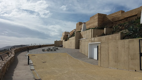
Attractions
Distance to the capital
Distance to the capital (Madrid) is about — 357 km.