
 Józefów nad Wisłą
Gorzyce Wielkie
Rogówek
Sromowce Niżne
Wyszków County
Kruszewo
Jantar
Sady Górne
Nagoszewo
Józefów nad Wisłą
Gorzyce Wielkie
Rogówek
Sromowce Niżne
Wyszków County
Kruszewo
Jantar
Sady Górne
Nagoszewo
Muzeum Mazowieckie w Płocku on the map, Plock, Poland
Photo
Where is located Muzeum Mazowieckie w Płocku
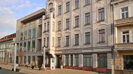
Muzeum Mazowieckie w Płocku — local attraction, which is located at Tumska 8, 09-402 Płock, Poland and belongs to the category — museum. Average visitor rating for this place — 4.7 (according to 602 ratings, information from open sources and relevant for 2022).
Exact location — Muzeum Mazowieckie w Płocku, marked on the map with a red marker.
You can get directions to Muzeum Mazowieckie w Płocku on the map from your location.
What else is interesting in Plock? You can see all the sights if you go to the city page.
Coordinates
Muzeum Mazowieckie w Płocku, Poland coordinates in decimal format: latitude — 52.54341911800662, longitude — 19.690163925357805. When converted to degrees, minutes, seconds Muzeum Mazowieckie w Płocku has the following coordinates: 52°32′36.31 north latitude and 19°41′24.59 east longitude.
Nearby cities
The largest cities that are located nearby:
- Wloclawek — 44 km
- Łódź — 89 km
- Torun — 90 km
- Bydgoszcz — 129 km
- Kalisz — 140 km
- Olsztyn — 145 km
- Radom — 161 km
- Elblag — 179 km
- Poznań — 188 km
- Częstochowa — 196 km
- Kielce — 197 km
- Gdańsk — 211 km
- Gdynia — 231 km
- Bialystok — 239 km
- Opole — 242 km
- Wrocław — 244 km
- Lublin — 245 km
- Kaliningrad
 (Russia) — 245 km
 - Dabrowa Gornicza — 249 km
Distance to the capital
Distance to the capital (Warsaw) is about — 96 km.