
 Józefów nad Wisłą
Gorzyce Wielkie
Rogówek
Sromowce Niżne
Wyszków County
Kruszewo
Jantar
Sady Górne
Nagoszewo
Józefów nad Wisłą
Gorzyce Wielkie
Rogówek
Sromowce Niżne
Wyszków County
Kruszewo
Jantar
Sady Górne
Nagoszewo
Muzeum Żołnierzy Wyklętych w Ostrołęce on the map, Ostroleka, Poland
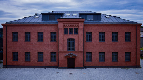
Photo
Where is located Muzeum Żołnierzy Wyklętych w Ostrołęce
Muzeum Żołnierzy Wyklętych w Ostrołęce — local attraction, which is located at Traugutta 19, 07-410 Ostrołęka, Poland and belongs to the category — history museum. Average visitor rating for this place — 3.8 (according to 87 ratings, information from open sources and relevant for 2022).
Exact location — Muzeum Żołnierzy Wyklętych w Ostrołęce, marked on the map with a red marker.
You can get directions to Muzeum Żołnierzy Wyklętych w Ostrołęce on the map from your location.
What else is interesting in Ostroleka? You can see all the sights if you go to the city page.
Coordinates
Muzeum Żołnierzy Wyklętych w Ostrołęce, Poland coordinates in decimal format: latitude — 53.08994148501324, longitude — 21.5795309253782. When converted to degrees, minutes, seconds Muzeum Żołnierzy Wyklętych w Ostrołęce has the following coordinates: 53°5′23.79 north latitude and 21°34′46.31 east longitude.
Nearby cities
The largest cities that are located nearby:
- Olsztyn — 104 km
- Bialystok — 107 km
- Plock — 138 km
- Wloclawek — 174 km
- Elblag — 183 km
- Brest
 (Belarus) — 184 km
 - Radom — 188 km
- Kaliningrad
 (Russia) — 192 km
 - Torun — 197 km
- Łódź — 206 km
- Lublin — 215 km
- Gdańsk — 234 km
- Bydgoszcz — 236 km
- Kaunas
 (Lithuania) — 250 km
 - Gdynia — 251 km
- Kielce — 254 km
- Kalisz — 279 km
- Klaipėda (Lithuania) — 290 km
- Baranovichi (Belarus) — 295 km
Distance to the capital
Distance to the capital (Warsaw) is about — 103 km.