
 Józefów nad Wisłą
Gorzyce Wielkie
Rogówek
Sromowce Niżne
Wyszków County
Kruszewo
Jantar
Sady Górne
Nagoszewo
Józefów nad Wisłą
Gorzyce Wielkie
Rogówek
Sromowce Niżne
Wyszków County
Kruszewo
Jantar
Sady Górne
Nagoszewo
Długa on the map, Wolomin, Poland
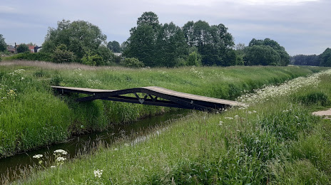
Photo
Where is located Długa
Długa — local attraction, which is located at Kanał Żerański and belongs to the category — -. Average visitor rating for this place — 4.2 (according to 17 ratings, information from open sources and relevant for 2022).
Exact location — Długa, marked on the map with a red marker.
You can get directions to Długa on the map from your location.
What else is interesting in Wolomin? You can see all the sights if you go to the city page.
Coordinates
Długa, Poland coordinates in decimal format: latitude — 52.351676589878714, longitude — 21.25328992535065. When converted to degrees, minutes, seconds Długa has the following coordinates: 52°21′6.04 north latitude and 21°15′11.84 east longitude.
Nearby cities
The largest cities that are located nearby:
- Radom — 104 km
- Plock — 106 km
- Łódź — 138 km
- Wloclawek — 150 km
- Lublin — 152 km
- Bialystok — 155 km
- Olsztyn — 167 km
- Kielce — 168 km
- Brest
 (Belarus) — 171 km
 - Torun — 191 km
- Częstochowa — 225 km
- Kalisz — 225 km
- Bydgoszcz — 231 km
- Elblag — 233 km
- Tarnow — 258 km
- Rzeszow — 260 km
- Dabrowa Gornicza — 266 km
- Kaliningrad
 (Russia) — 267 km
 - Kraków — 268 km
Distance to the capital
Distance to the capital (Warsaw) is about — 21 km.