
 Józefów nad Wisłą
Gorzyce Wielkie
Rogówek
Sromowce Niżne
Wyszków County
Kruszewo
Jantar
Sady Górne
Nagoszewo
Józefów nad Wisłą
Gorzyce Wielkie
Rogówek
Sromowce Niżne
Wyszków County
Kruszewo
Jantar
Sady Górne
Nagoszewo
Park archeologiczny Osada VI Oraczy on the map, Bochnia, Poland
Photo
Where is located Park archeologiczny Osada VI Oraczy
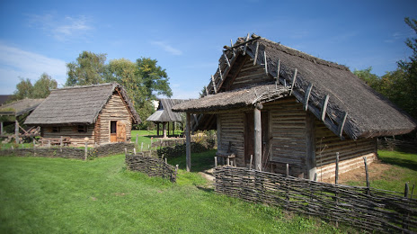
Park archeologiczny Osada VI Oraczy — local attraction, which is located at Kopalnia Soli, Campi 15, 32-701 Bochnia, Poland and belongs to the category — archaeological museum. Average visitor rating for this place — 4.1 (according to 20 ratings, information from open sources and relevant for 2022).
Exact location — Park archeologiczny Osada VI Oraczy, marked on the map with a red marker.
You can get directions to Park archeologiczny Osada VI Oraczy on the map from your location.
What else is interesting in Bochnia? You can see all the sights if you go to the city page.
Coordinates
Park archeologiczny Osada VI Oraczy, Poland coordinates in decimal format: latitude — 49.96992962638337, longitude — 20.4181697252635. When converted to degrees, minutes, seconds Park archeologiczny Osada VI Oraczy has the following coordinates: 49°58′11.75 north latitude and 20°25′5.41 east longitude.
Nearby cities
The largest cities that are located nearby:
- Kraków — 36 km
- Tarnow — 40 km
- Dabrowa Gornicza — 96 km
- Bielsko-Biala — 99 km
- Sosnowiec — 100 km
- Kielce — 100 km
- Katowice — 105 km
- Chorzow — 110 km
- Rzeszow — 112 km
- Bytom — 115 km
- Ruda Slaska — 116 km
- Zabrze — 123 km
- Gliwice — 129 km
- Częstochowa — 131 km
- Rybnik — 134 km
- Košice
 (Slovakia) — 151 km
 - Ostrava
 (Czech Republic) — 155 km
 - Radom — 166 km
- Opole — 192 km
Distance to the capital
Distance to the capital (Warsaw) is about — 255 km.