
 Gilserberg
Berlin
Bordesholm
Bechtolsheim
Aub
Triptis
Heppenheim
Biblis
Angermünde
Gilserberg
Berlin
Bordesholm
Bechtolsheim
Aub
Triptis
Heppenheim
Biblis
Angermünde
Pfarrei Bogenberg on the map, Straubing, Germany
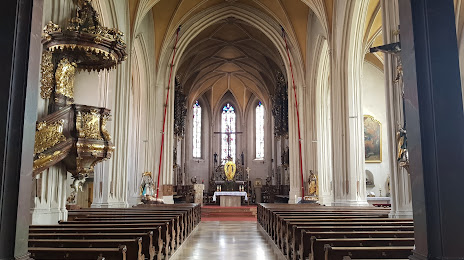
Photo
Where is located Pfarrei Bogenberg
Pfarrei Bogenberg — local attraction, which is located at Bogenberg 10, 94327 Bogen, Germany and belongs to the category — church. Average visitor rating for this place — 4.7 (according to 481 rating, information from open sources and relevant for 2022).
Exact location — Pfarrei Bogenberg, marked on the map with a red marker.
You can get directions to Pfarrei Bogenberg on the map from your location.
What else is interesting in Straubing? You can see all the sights if you go to the city page.
Coordinates
Pfarrei Bogenberg, Germany coordinates in decimal format: latitude — 48.901797242523216, longitude — 12.696524725225343. When converted to degrees, minutes, seconds Pfarrei Bogenberg has the following coordinates: 48°54′6.47 north latitude and 12°41′47.49 east longitude.
Nearby cities
The largest cities that are located nearby:
- Regensburg — 38 km
- Ingolstadt — 85 km
- Munich — 110 km
- Pilsen
 (Czech Republic) — 111 km
 - Salzburg
 (Austria) — 123 km
 - Nuremberg — 125 km
- Fürth — 132 km
- Augsburg — 136 km
- Erlangen — 137 km
- Linz (Austria) — 140 km
- Prague (Czech Republic) — 187 km
- Ulm — 197 km
- Innsbruck (Austria) — 199 km
- Würzburg — 213 km
- Chemnitz — 217 km
- Gera — 225 km
- Heilbronn — 245 km
- Stuttgart — 248 km
- Reutlingen — 251 km
Distance to the capital
Distance to the capital (Berlin) is about — 406 km.