
 Gilserberg
Berlin
Bordesholm
Bechtolsheim
Aub
Triptis
Heppenheim
Biblis
Angermünde
Gilserberg
Berlin
Bordesholm
Bechtolsheim
Aub
Triptis
Heppenheim
Biblis
Angermünde
Buxtehude · Museum of Regional History and Art on the map, Buxtehude, Germany
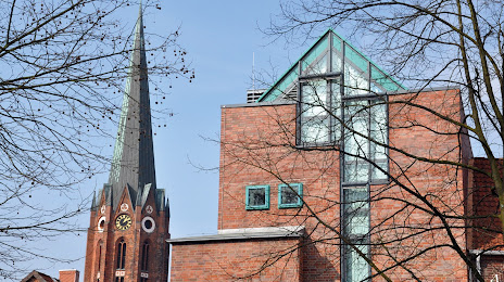
Photo
Where is located Buxtehude · Museum of Regional History and Art
Buxtehude · Museum of Regional History and Art — local attraction, which is located at St.-Petri-Platz 11, 21614 Buxtehude, Germany and belongs to the category — museum. Average visitor rating for this place — 3.8 (according to 16 ratings, information from open sources and relevant for 2022).
Exact location — Buxtehude · Museum of Regional History and Art, marked on the map with a red marker.
You can get directions to Buxtehude · Museum of Regional History and Art on the map from your location.
What else is interesting in Buxtehude? You can see all the sights if you go to the city page.
Coordinates
Buxtehude · Museum of Regional History and Art, Germany coordinates in decimal format: latitude — 53.47673484635758, longitude — 9.701530225392796. When converted to degrees, minutes, seconds Buxtehude · Museum of Regional History and Art has the following coordinates: 53°28′36.25 north latitude and 9°42′5.51 east longitude.
Nearby cities
The largest cities that are located nearby:
- Bremen — 73 km
- Bremerhaven — 73 km
- Kiel — 99 km
- Hanover — 121 km
- Wolfsburg — 137 km
- Brunswick — 144 km
- Hildesheim — 146 km
- Salzgitter — 152 km
- Rostock — 171 km
- Osnabrück — 172 km
- Bielefeld — 177 km
- Magdeburg — 199 km
- Emmen
 (Netherlands) — 201 km
 - Paderborn — 204 km
- Groningen (Netherlands) — 209 km
- Göttingen — 214 km
- Münster — 218 km
- Odense
 (Denmark) — 219 km
 - Enschede (Netherlands) — 234 km
Distance to the capital
Distance to the capital (Berlin) is about — 270 km.