
 Gilserberg
Berlin
Bordesholm
Bechtolsheim
Aub
Triptis
Heppenheim
Biblis
Angermünde
Gilserberg
Berlin
Bordesholm
Bechtolsheim
Aub
Triptis
Heppenheim
Biblis
Angermünde
Warwer Sand on the map, Syke, Germany
Photo
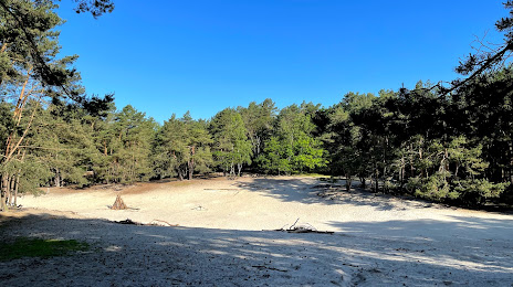
Where is located Warwer Sand
Warwer Sand — local attraction, which is located at Zum Warwer Sand, 28816 Stuhr, Germany and belongs to the category — wildlife refuge. Average visitor rating for this place — 4.7 (according to 48 ratings, information from open sources and relevant for 2022).
Exact location — Warwer Sand, marked on the map with a red marker.
You can get directions to Warwer Sand on the map from your location.
What else is interesting in Syke? You can see all the sights if you go to the city page.
Coordinates
Warwer Sand, Germany coordinates in decimal format: latitude — 52.94734228899702, longitude — 8.749419225372874. When converted to degrees, minutes, seconds Warwer Sand has the following coordinates: 52°56′50.43 north latitude and 8°44′57.91 east longitude.
Nearby cities
The largest cities that are located nearby:
- Bremen — 18 km
- Bremerhaven — 71 km
- Hanover — 86 km
- Osnabrück — 87 km
- Bielefeld — 99 km
- Hildesheim — 114 km
- Emmen
 (Netherlands) — 129 km
 - Paderborn — 132 km
- Münster — 133 km
- Salzgitter — 133 km
- Brunswick — 136 km
- Wolfsburg — 143 km
- Enschede (Netherlands) — 151 km
- Groningen (Netherlands) — 153 km
- Hamm — 153 km
- Göttingen — 169 km
- Kiel — 177 km
- Dortmund — 181 km
- Recklinghausen — 182 km
Distance to the capital
Distance to the capital (Berlin) is about — 317 km.