
 Puerto de la Duquesa
La Serna de Iguña
Pumalverde
Puentenansa
La Iglesia
Casar de Periedo
Fuengirola
Renedo de Piélagos
Villabanez
Puerto de la Duquesa
La Serna de Iguña
Pumalverde
Puentenansa
La Iglesia
Casar de Periedo
Fuengirola
Renedo de Piélagos
Villabanez
Paraje Natural Desembocadura Rio Velez on the map, Vélez-Málaga, Spain
Photo
Where is located Paraje Natural Desembocadura Rio Velez
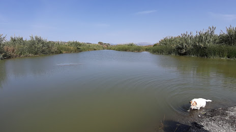
Paraje Natural Desembocadura Rio Velez — local attraction, which is located at C. del Río, 29740 Vélez-Málaga, Málaga, Spain and belongs to the category — nature preserve. Average visitor rating for this place — 3.9 (according to 37 ratings, information from open sources and relevant for 2022).
Exact location — Paraje Natural Desembocadura Rio Velez, marked on the map with a red marker.
You can get directions to Paraje Natural Desembocadura Rio Velez on the map from your location.
What else is interesting in Vélez-Málaga? You can see all the sights if you go to the city page.
Coordinates
Paraje Natural Desembocadura Rio Velez, Spain coordinates in decimal format: latitude — 36.72950748530073, longitude — -4.108382675162657. When converted to degrees, minutes, seconds Paraje Natural Desembocadura Rio Velez has the following coordinates: 36°43′46.23 north latitude and -4°6′30.18 east longitude.
Nearby cities
The largest cities that are located nearby:
- Málaga — 29 km
- Granada — 62 km
- Marbella — 76 km
- Jaén — 114 km
- Córdoba — 136 km
- Algeciras — 140 km
- Almería — 145 km
- Dos Hermanas — 170 km
- Tetouan
 (Morocco) — 176 km
 - Jerez — 180 km
- Tangier (Morocco) — 192 km
- Cádiz — 196 km
- Nador (Morocco) — 207 km
- Taounate (Morocco) — 253 km
- Huelva — 256 km
- Taza (Morocco) — 283 km
- Cartagena — 287 km
- Murcia — 291 km
- Oujda (Morocco) — 305 km
Distance to the capital
Distance to the capital (Madrid) is about — 412 km.