
 Gilserberg
Berlin
Bordesholm
Bechtolsheim
Aub
Triptis
Heppenheim
Biblis
Angermünde
Gilserberg
Berlin
Bordesholm
Bechtolsheim
Aub
Triptis
Heppenheim
Biblis
Angermünde
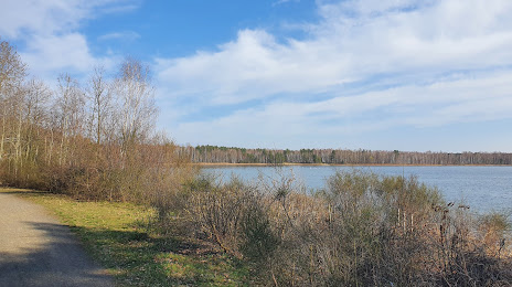
Grünewalder Lauch on the map, Lauchhammer, Germany
Photo
Where is located Grünewalder Lauch
Grünewalder Lauch — local attraction, which is located at no data and belongs to the category — -. Average visitor rating for this place — 4.6 (according to 163 ratings, information from open sources and relevant for 2022).
Exact location — Grünewalder Lauch, marked on the map with a red marker.
You can get directions to Grünewalder Lauch on the map from your location.
What else is interesting in Lauchhammer? You can see all the sights if you go to the city page.
Coordinates
Grünewalder Lauch, Germany coordinates in decimal format: latitude — 51.51249038785099, longitude — 13.65845588121551. When converted to degrees, minutes, seconds Grünewalder Lauch has the following coordinates: 51°30′44.97 north latitude and 13°39′30.44 east longitude.
Nearby cities
The largest cities that are located nearby:
- Cottbus — 48 km
- Dresden — 50 km
- Chemnitz — 95 km
- Leipzig — 98 km
- Potsdam — 110 km
- Berlin — 114 km
- Zielona Gora
 (Poland) — 128 km
 - Gera — 136 km
- Magdeburg — 161 km
- Prague
 (Czech Republic) — 164 km
 - Gorzów Wielkopolski (Poland) — 168 km
- Legnica (Poland) — 168 km
- Walbrzych (Poland) — 192 km
- Pilsen (Czech Republic) — 197 km
- Erfurt — 199 km
- Szczecin (Poland) — 220 km
- Wolfsburg — 226 km
- Wrocław (Poland) — 231 km
- Poznań (Poland) — 235 km
Distance to the capital
Distance to the capital (Berlin) is about — 113 km.