
 Puerto de la Duquesa
La Serna de Iguña
Pumalverde
Puentenansa
La Iglesia
Casar de Periedo
Fuengirola
Renedo de Piélagos
Villabanez
Puerto de la Duquesa
La Serna de Iguña
Pumalverde
Puentenansa
La Iglesia
Casar de Periedo
Fuengirola
Renedo de Piélagos
Villabanez
Alcázar de Segovia on the map, Segovia, Spain
Photo
Where is located Alcázar de Segovia
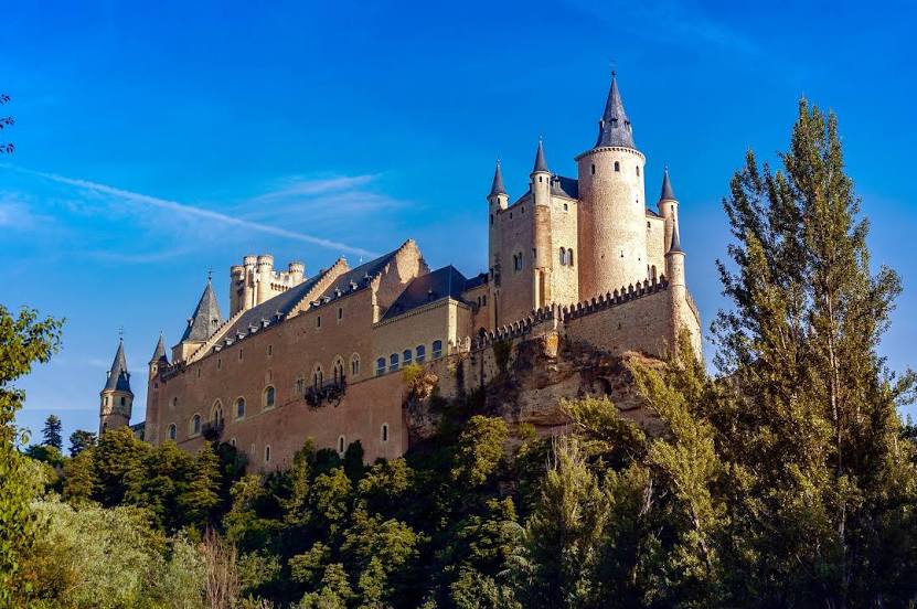
Alcázar de Segovia — local attraction, which is located at Pl. Reina Victoria Eugenia, s/n, 40003 Segovia, Spain and belongs to the category — medieval castle. Average visitor rating for this place — 4.7 (according to 31645 ratings, information from open sources and relevant for 2022).
Exact location — Alcázar de Segovia, marked on the map with a red marker.
You can get directions to Alcázar de Segovia on the map from your location.
What else is interesting in Segovia? You can see all the sights if you go to the city page.
Coordinates
Alcázar de Segovia, Spain coordinates in decimal format: latitude — 40.95253601589153, longitude — -4.132602175038236. When converted to degrees, minutes, seconds Alcázar de Segovia has the following coordinates: 40°57′9.13 north latitude and -4°7′57.37 east longitude.
Nearby cities
The largest cities that are located nearby:
- Alcobendas — 60 km
- Alcorcón — 70 km
- Móstoles — 71 km
- Leganés — 73 km
- Torrejón de Ardoz — 76 km
- Fuenlabrada — 77 km
- Getafe — 77 km
- Alcala de Henares — 81 km
- Valladolid — 93 km
- Salamanca — 130 km
- Burgos — 159 km
- Logroño — 216 km
- León — 218 km
- Vitoria-Gasteiz — 241 km
- Bilbao — 273 km
- Zaragoza — 277 km
- Santander — 280 km
- Pamplona — 287 km
- Albacete — 289 km
Distance to the capital
Distance to the capital (Madrid) is about — 70 km.