
 Puerto de la Duquesa
La Serna de Iguña
Pumalverde
Puentenansa
La Iglesia
Casar de Periedo
Fuengirola
Renedo de Piélagos
Villabanez
Puerto de la Duquesa
La Serna de Iguña
Pumalverde
Puentenansa
La Iglesia
Casar de Periedo
Fuengirola
Renedo de Piélagos
Villabanez
Bosque de Valdenazar on the map, Guadalajara, Spain
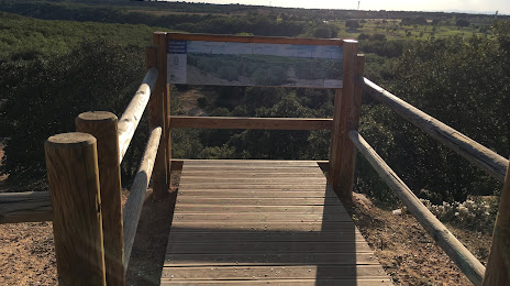
Photo
Where is located Bosque de Valdenazar
Bosque de Valdenazar — local attraction, which is located at Poligono Sector S 1, 2201, 19141 Yebes, Guadalajara, Spain and belongs to the category — national forest. Average visitor rating for this place — 4.5 (according to 354 ratings, information from open sources and relevant for 2022).
Exact location — Bosque de Valdenazar, marked on the map with a red marker.
You can get directions to Bosque de Valdenazar on the map from your location.
What else is interesting in Guadalajara? You can see all the sights if you go to the city page.
Coordinates
Bosque de Valdenazar, Spain coordinates in decimal format: latitude — 40.58291611255212, longitude — -3.116116375049575. When converted to degrees, minutes, seconds Bosque de Valdenazar has the following coordinates: 40°34′58.5 north latitude and -3°6′58.02 east longitude.
Nearby cities
The largest cities that are located nearby:
- Alcala de Henares — 24 km
- Torrejón de Ardoz — 33 km
- Alcobendas — 41 km
- Getafe — 60 km
- Leganés — 61 km
- Alcorcón — 65 km
- Fuenlabrada — 66 km
- Móstoles — 69 km
- Valladolid — 172 km
- Burgos — 194 km
- Logroño — 211 km
- Salamanca — 212 km
- Albacete — 213 km
- Zaragoza — 219 km
- Vitoria-Gasteiz — 249 km
- Valencia — 270 km
- Pamplona — 271 km
- Bilbao — 291 km
- León — 293 km
Distance to the capital
Distance to the capital (Madrid) is about — 53 km.