
 Puerto de la Duquesa
La Serna de Iguña
Pumalverde
Puentenansa
La Iglesia
Casar de Periedo
Fuengirola
Renedo de Piélagos
Villabanez
Puerto de la Duquesa
La Serna de Iguña
Pumalverde
Puentenansa
La Iglesia
Casar de Periedo
Fuengirola
Renedo de Piélagos
Villabanez
La Fiesta del Árbol on the map, Albacete, Spain
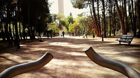
Photo
Where is located La Fiesta del Árbol
La Fiesta del Árbol — local attraction, which is located at 02006 Albacete, Spain and belongs to the category — park. Average visitor rating for this place — 4.4 (according to 1566 ratings, information from open sources and relevant for 2022).
Exact location — La Fiesta del Árbol, marked on the map with a red marker.
You can get directions to La Fiesta del Árbol on the map from your location.
What else is interesting in Albacete? You can see all the sights if you go to the city page.
Coordinates
La Fiesta del Árbol, Spain coordinates in decimal format: latitude — 39.000727559529174, longitude — -1.8767094750971551. When converted to degrees, minutes, seconds La Fiesta del Árbol has the following coordinates: 39°0′2.62 north latitude and -1°52′36.15 east longitude.
Nearby cities
The largest cities that are located nearby:
- Murcia — 128 km
- Valencia — 137 km
- Cartagena — 169 km
- Alcala de Henares — 208 km
- Torrejón de Ardoz — 211 km
- Getafe — 215 km
- Jaén — 215 km
- Fuenlabrada — 218 km
- Leganés — 219 km
- Alcorcón — 223 km
- Móstoles — 224 km
- Alcobendas — 227 km
- Almería — 245 km
- Granada — 253 km
- Córdoba — 283 km
- Zaragoza — 304 km
- Málaga — 339 km
- Tarragona — 349 km
- Lleida — 355 km
Distance to the capital
Distance to the capital (Madrid) is about — 222 km.