
 Puerto de la Duquesa
La Serna de Iguña
Pumalverde
Puentenansa
La Iglesia
Casar de Periedo
Fuengirola
Renedo de Piélagos
Villabanez
Puerto de la Duquesa
La Serna de Iguña
Pumalverde
Puentenansa
La Iglesia
Casar de Periedo
Fuengirola
Renedo de Piélagos
Villabanez
Poblament fenici de sa Caleta on the map, Ibiza, Spain
Photo
Where is located Poblament fenici de sa Caleta
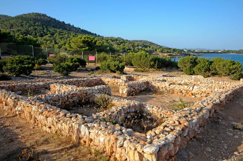
Poblament fenici de sa Caleta — local attraction, which is located at Diseminado Sa Caleta, 07818 Sant Josep de sa Talaia, Balearic Islands, Spain and belongs to the category — historical landmark. Average visitor rating for this place — 4.2 (according to 137 ratings, information from open sources and relevant for 2022).
Exact location — Poblament fenici de sa Caleta, marked on the map with a red marker.
You can get directions to Poblament fenici de sa Caleta on the map from your location.
What else is interesting in Ibiza? You can see all the sights if you go to the city page.
Coordinates
Poblament fenici de sa Caleta, Spain coordinates in decimal format: latitude — 38.86690678868688, longitude — 1.3347181248988738. When converted to degrees, minutes, seconds Poblament fenici de sa Caleta has the following coordinates: 38°52′0.86 north latitude and 1°20′4.99 east longitude.
Nearby cities
The largest cities that are located nearby:
- Palma — 128 km
- Valencia — 166 km
- Murcia — 244 km
- Tarragona — 245 km
- Cartagena — 255 km
- Sidi M'Hamed
 (Algeria) — 278 km
 - L'Hospitalet de Llobregat — 278 km
- Albacete — 282 km
- Santa Coloma de Gramenet — 288 km
- Badalona — 289 km
- Sabadell — 297 km
- Terrassa — 298 km
- Mataró — 303 km
- Chlef (Algeria) — 303 km
- Lleida — 307 km
- Médéa (Algeria) — 315 km
- Zaragoza — 358 km
- Relizane (Algeria) — 359 km
- Oran (Algeria) — 400 km
Distance to the capital
Distance to the capital (Madrid) is about — 465 km.