
 Gilserberg
Berlin
Bordesholm
Bechtolsheim
Aub
Triptis
Heppenheim
Biblis
Angermünde
Gilserberg
Berlin
Bordesholm
Bechtolsheim
Aub
Triptis
Heppenheim
Biblis
Angermünde
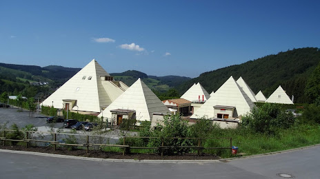
Die Sauerland-Pyramiden on the map, Lennestadt, Germany
Photo
Where is located Die Sauerland-Pyramiden
Die Sauerland-Pyramiden — local attraction, which is located at Sauerland-Pyramiden 1, 57368 Lennestadt, Germany and belongs to the category — science museum. Average visitor rating for this place — 4.5 (according to 13 ratings, information from open sources and relevant for 2022).
Exact location — Die Sauerland-Pyramiden, marked on the map with a red marker.
You can get directions to Die Sauerland-Pyramiden on the map from your location.
What else is interesting in Lennestadt? You can see all the sights if you go to the city page.
Coordinates
Die Sauerland-Pyramiden, Germany coordinates in decimal format: latitude — 51.12911578077548, longitude — 8.061887675305531. When converted to degrees, minutes, seconds Die Sauerland-Pyramiden has the following coordinates: 51°7′44.82 north latitude and 8°3′42.8 east longitude.
Nearby cities
The largest cities that are located nearby:
- Siegen — 25 km
- Hagen — 51 km
- Dortmund — 62 km
- Remscheid — 62 km
- Witten — 62 km
- Hamm — 65 km
- Wuppertal — 66 km
- Bergisch Gladbach — 67 km
- Solingen — 69 km
- Bochum — 72 km
- Herne — 77 km
- Bonn — 79 km
- Cologne — 80 km
- Gelsenkirchen — 82 km
- Recklinghausen — 82 km
- Paderborn — 83 km
- Essen — 83 km
- Mülheim — 89 km
- Koblenz — 89 km
Distance to the capital
Distance to the capital (Berlin) is about — 398 km.