
 Puerto de la Duquesa
La Serna de Iguña
Pumalverde
Puentenansa
La Iglesia
Casar de Periedo
Fuengirola
Renedo de Piélagos
Villabanez
Puerto de la Duquesa
La Serna de Iguña
Pumalverde
Puentenansa
La Iglesia
Casar de Periedo
Fuengirola
Renedo de Piélagos
Villabanez
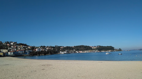
Playa Banda Do Rio, Bueu on the map, Bueu, Spain
Photo
Where is located Playa Banda Do Rio, Bueu
Playa Banda Do Rio, Bueu — local attraction, which is located at no data and belongs to the category — -. Average visitor rating for this place — 4.2 (according to 106 ratings, information from open sources and relevant for 2022).
Exact location — Playa Banda Do Rio, Bueu, marked on the map with a red marker.
You can get directions to Playa Banda Do Rio, Bueu on the map from your location.
What else is interesting in Bueu? You can see all the sights if you go to the city page.
Coordinates
Playa Banda Do Rio, Bueu, Spain coordinates in decimal format: latitude — 42.32710371802883, longitude — -8.793613311238685. When converted to degrees, minutes, seconds Playa Banda Do Rio, Bueu has the following coordinates: 42°19′37.57 north latitude and -8°47′37.01 east longitude.
Nearby cities
The largest cities that are located nearby:
- Vigo — 11 km
- Ourense — 75 km
- Braga
 (Portugal) — 91 km
 - A Coruña — 119 km
- Porto (Portugal) — 130 km
- Coimbra (Portugal) — 237 km
- Oviedo — 262 km
- León — 264 km
- Gijón — 284 km
- Salamanca — 301 km
- Valladolid — 344 km
- Amadora (Portugal) — 396 km
- Queluz (Portugal) — 397 km
- Lisbon (Portugal) — 400 km
- Badajoz — 412 km
- Burgos — 416 km
- Santander — 419 km
- Móstoles — 470 km
- Alcorcón — 472 km
Distance to the capital
Distance to the capital (Madrid) is about — 475 km.