
 Bel-Ha
San Jose El Alto
El Porvenir
Nueva Palestina
Santa Lucía
Chemax
La Morita
Temoac
Zacualpan
Bel-Ha
San Jose El Alto
El Porvenir
Nueva Palestina
Santa Lucía
Chemax
La Morita
Temoac
Zacualpan
Playa El Edén on the map, Manzanillo, Mexico
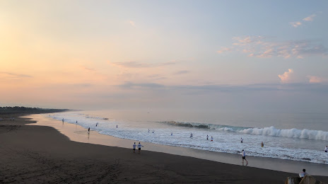
Photo
Where is located Playa El Edén
Playa El Edén — local attraction, which is located at Calle Leonidas Sánchez Casa Ejidal de Campos Campos, 28809 Manzanillo, Col., Mexico and belongs to the category — nature preserve. Average visitor rating for this place — 4.5 (according to 256 ratings, information from open sources and relevant for 2022).
Exact location — Playa El Edén, marked on the map with a red marker.
You can get directions to Playa El Edén on the map from your location.
What else is interesting in Manzanillo? You can see all the sights if you go to the city page.
Coordinates
Playa El Edén, Mexico coordinates in decimal format: latitude — 18.99531573644447, longitude — -104.24656157555064. When converted to degrees, minutes, seconds Playa El Edén has the following coordinates: 18°59′43.14 north latitude and -104°14′47.62 east longitude.
Nearby cities
The largest cities that are located nearby:
- Colima — 66 km
- Puerto Vallarta — 193 km
- Zapopan — 197 km
- Guadalajara — 199 km
- Tlaquepaque — 199 km
- Tonalá — 202 km
- Zamora — 234 km
- Uruapan — 241 km
- Tepic — 270 km
- Morelia — 334 km
- León — 352 km
- Irapuato — 354 km
- Salamanca — 362 km
- Aguascalientes — 371 km
- Celaya — 397 km
- Santiago de Querétaro — 440 km
- Zacatecas — 442 km
- San Juan del Río — 473 km
- Fresnillo — 473 km
Distance to the capital
Distance to the capital (Mexico City) is about — 539 km.