
 Bokamoso
Buysdorp
Xihosana
Ga-Sekororo
Ga-Rankuwa
Three Sisters
George
Haenertsburg
Polokwane
Bokamoso
Buysdorp
Xihosana
Ga-Sekororo
Ga-Rankuwa
Three Sisters
George
Haenertsburg
Polokwane
Springfield Estate on the map, Robertson, South Africa
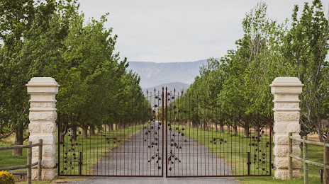
Photo
Where is located Springfield Estate
Springfield Estate — local attraction, which is located at Klipdrif, R317 Bonnievale Road, Robertson, 6705, South Africa and belongs to the category — winery. Average visitor rating for this place — 4.8 (according to 183 ratings, information from open sources and relevant for 2022).
Exact location — Springfield Estate, marked on the map with a red marker.
You can get directions to Springfield Estate on the map from your location.
What else is interesting in Robertson? You can see all the sights if you go to the city page.
Coordinates
Springfield Estate, South Africa coordinates in decimal format: latitude — -33.83695408307551, longitude — 19.915272624758835. When converted to degrees, minutes, seconds Springfield Estate has the following coordinates: -33°50′13.03 north latitude and 19°54′54.98 east longitude.
Nearby cities
The largest cities that are located nearby:
- Worcester — 44 km
- Paarl — 86 km
- Cape Town — 135 km
- Mossel Bay — 210 km
- George — 236 km
- Uitenhage — 508 km
- Port Elizabeth — 524 km
- Queenstown — 693 km
- Bisho — 709 km
- Kimberley — 733 km
- East London — 746 km
- Bloemfontein — 801 km
- Botshabelo — 828 km
- Maseru
 (Lesotho) — 885 km
 - Virginia — 926 km
- Welkom — 927 km
- Kroonstad — 990 km
- Orkney — 1008 km
- Klerksdorp — 1016 km
Distance to the capital
Distance to the capital (Pretoria) is about — 1202 km.