
Other locations
Uruará  Belém
Maranguape
Paranaguá
Paranaguá
Monte Alegre
Alvorada de Minas
Bragança
Laguna
Ibiporã
Belém
Maranguape
Paranaguá
Paranaguá
Monte Alegre
Alvorada de Minas
Bragança
Laguna
Ibiporã
Caúra on the map, São José de Ribamar, Brazil
Comments
Where is located Caúra on the map, São José de Ribamar, Brazil. Geographic coordinates in decimal format, as well as degrees, minutes and seconds. Photo, address and average rating of visitors who have been here.
Photo
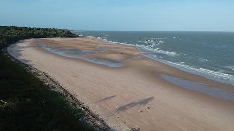
Where is located Caúra
Caúra — local attraction, which is located at no data and belongs to the category — -. Average visitor rating for this place — 4.6 (according to 60 ratings, information from open sources and relevant for 2022).
Exact location — Caúra, marked on the map with a red marker.
You can get directions to Caúra on the map from your location.
What else is interesting in São José de Ribamar? You can see all the sights if you go to the city page.
Coordinates
Caúra, Brazil coordinates in decimal format: latitude — -2.556898829832446, longitude — -44.03737907569476. When converted to degrees, minutes, seconds Caúra has the following coordinates: -2°33′24.84 north latitude and -44°2′14.56 east longitude.
Nearby cities
The largest cities that are located nearby:
- São Luís — 24 km
- Parnaíba — 257 km
- Caxias — 268 km
- Timon — 313 km
- Teresina — 314 km
- Castanhal — 447 km
- Ananindeua — 494 km
- Imperatriz — 498 km
- Belém — 503 km
- Caucaia — 611 km
- Maracanaú — 618 km
- Fortaleza — 625 km
- Marabá — 639 km
- Araguaína — 685 km
- Juazeiro do Norte — 735 km
- Mossoro — 795 km
- Macapá — 825 km
- Petrolina — 850 km
- Palmas — 969 km