
 Bel-Ha
San Jose El Alto
El Porvenir
Nueva Palestina
Santa Lucía
Chemax
La Morita
Temoac
Zacualpan
Bel-Ha
San Jose El Alto
El Porvenir
Nueva Palestina
Santa Lucía
Chemax
La Morita
Temoac
Zacualpan
Playa Las Escolleras on the map, Salina Cruz, Mexico
Photo
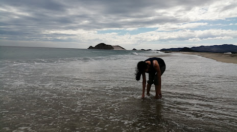
Where is located Playa Las Escolleras
Playa Las Escolleras — local attraction, which is located at no data and belongs to the category — -. Average visitor rating for this place — 4.3 (according to 211 ratings, information from open sources and relevant for 2022).
Exact location — Playa Las Escolleras, marked on the map with a red marker.
You can get directions to Playa Las Escolleras on the map from your location.
What else is interesting in Salina Cruz? You can see all the sights if you go to the city page.
Coordinates
Playa Las Escolleras, Mexico coordinates in decimal format: latitude — 16.157047652555157, longitude — -95.2351223496282. When converted to degrees, minutes, seconds Playa Las Escolleras has the following coordinates: 16°9′25.37 north latitude and -95°14′6.44 east longitude.
Nearby cities
The largest cities that are located nearby:
- Oaxaca — 187 km
- Minatitlán — 211 km
- Coatzacoalcos — 230 km
- Tuxtla Gutiérrez — 232 km
- San Cristóbal de las Casas — 279 km
- Villahermosa — 310 km
- Tehuacán — 341 km
- Tapachula — 345 km
- Córdoba — 348 km
- Orizaba — 355 km
- Xalapa — 412 km
- Quetzaltenango
 (Guatemala) — 422 km
 - Puebla — 445 km
- Ciudad del Carmen — 449 km
- Martínez de la Torre — 470 km
- Chilpancingo — 477 km
- Cuautla — 488 km
- Acapulco — 500 km
- Jiutepec — 512 km
Distance to the capital
Distance to the capital (Mexico City) is about — 551 km.