
 Belém
Maranguape
Paranaguá
Paranaguá
Monte Alegre
Alvorada de Minas
Bragança
Laguna
Ibiporã
Belém
Maranguape
Paranaguá
Paranaguá
Monte Alegre
Alvorada de Minas
Bragança
Laguna
Ibiporã
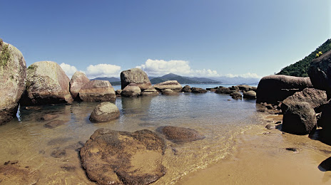
Ilhabela State Park (Parque Estadual Ilhabela) on the map, Ilhabela, Brazil
Photo
Where is located Ilhabela State Park (Parque Estadual Ilhabela)
Ilhabela State Park (Parque Estadual Ilhabela) — local attraction, which is located at Praça Cel. Julião de Moura Negrão, 115 - Centro, Ilhabela - SP, 11630-000, Brazil and belongs to the category — state park. Average visitor rating for this place — 4.7 (according to 2603 ratings, information from open sources and relevant for 2022).
Exact location — Ilhabela State Park (Parque Estadual Ilhabela), marked on the map with a red marker.
You can get directions to Ilhabela State Park (Parque Estadual Ilhabela) on the map from your location.
What else is interesting in Ilhabela? You can see all the sights if you go to the city page.
Coordinates
Ilhabela State Park (Parque Estadual Ilhabela), Brazil coordinates in decimal format: latitude — -23.821618424672565, longitude — -45.357975215258215. When converted to degrees, minutes, seconds Ilhabela State Park (Parque Estadual Ilhabela) has the following coordinates: -23°49′17.83 north latitude and -45°21′28.71 east longitude.
Nearby cities
The largest cities that are located nearby:
- Jacareí — 84 km
- São José dos Campos — 85 km
- Mogi das Cruzes — 89 km
- Taubaté — 90 km
- Guarujá — 92 km
- Santos — 99 km
- Pindamonhangaba — 99 km
- Suzano — 100 km
- Poá — 104 km
- São Vicente — 105 km
- Ribeirão Pires — 106 km
- Itaquaquecetuba — 106 km
- Cubatão — 107 km
- Praia Grande — 108 km
- Mauá — 112 km
- Guaratinguetá — 113 km
- Saint Andrew — 120 km
- São Bernardo do Campo — 122 km
- São Caetano do Sul — 122 km