
 Belém
Maranguape
Paranaguá
Paranaguá
Monte Alegre
Alvorada de Minas
Bragança
Laguna
Ibiporã
Belém
Maranguape
Paranaguá
Paranaguá
Monte Alegre
Alvorada de Minas
Bragança
Laguna
Ibiporã
Lago de Acajatuba on the map, Manacapuru, Brazil
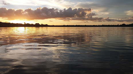
Photo
Where is located Lago de Acajatuba
Lago de Acajatuba — local attraction, which is located at no data and belongs to the category — -. Average visitor rating for this place — 4.6 (according to 73 ratings, information from open sources and relevant for 2022).
Exact location — Lago de Acajatuba, marked on the map with a red marker.
You can get directions to Lago de Acajatuba on the map from your location.
What else is interesting in Manacapuru? You can see all the sights if you go to the city page.
Coordinates
Lago de Acajatuba, Brazil coordinates in decimal format: latitude — -3.1169477447569016, longitude — -60.51222305424791. When converted to degrees, minutes, seconds Lago de Acajatuba has the following coordinates: -3°7′1.01 north latitude and -60°30′44 east longitude.
Nearby cities
The largest cities that are located nearby:
- Manaus — 70 km
- Santarém — 662 km
- Boa Vista — 676 km
- Porto Velho — 702 km
- White River — 1077 km
- Sinop — 1098 km
- Macapá — 1119 km
- Georgetown
 (Guyana) — 1148 km
 - Paramaribo
 (Suriname) — 1174 km
 - Marabá — 1287 km
- Ciudad Bolivar
 (Venezuela) — 1298 km
 - Belém — 1357 km
- Ananindeua — 1371 km
- Iquitos
 (Peru) — 1393 km
 - El Tigre (Venezuela) — 1402 km
- Castanhal — 1423 km
- Araguaína — 1430 km
- Cuiaba — 1444 km
- Várzea Grande — 1448 km