
 La Ensenada
Obero
Cuilapa
Laguna de Montebello
Uaxactun
Melchor de Mencos
Petetan
El Subin
Patanatic
La Ensenada
Obero
Cuilapa
Laguna de Montebello
Uaxactun
Melchor de Mencos
Petetan
El Subin
Patanatic
Laguna Lemoa on the map, Chichicastenango, Guatemala
Photo
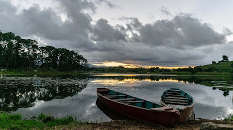
Where is located Laguna Lemoa
Laguna Lemoa — local attraction, which is located at 1,935 m and belongs to the category — -. Average visitor rating for this place — 4.5 (according to 33 ratings, information from open sources and relevant for 2022).
Exact location — Laguna Lemoa, marked on the map with a red marker.
You can get directions to Laguna Lemoa on the map from your location.
What else is interesting in Chichicastenango? You can see all the sights if you go to the city page.
Coordinates
Laguna Lemoa, Guatemala coordinates in decimal format: latitude — 14.941150203994166, longitude — -91.10843375061657. When converted to degrees, minutes, seconds Laguna Lemoa has the following coordinates: 14°56′28.14 north latitude and -91°6′30.36 east longitude.
Nearby cities
The largest cities that are located nearby:
- Quetzaltenango — 45 km
- San Juan Sacatepéquez — 56 km
- Villa Nueva — 72 km
- Escuintla — 79 km
- Villa Canales — 82 km
- Tapachula
 (Mexico) — 123 km
 - Santa Ana
 (El Salvador) — 197 km
 - Santa Tecla (El Salvador) — 241 km
- Apopa (El Salvador) — 242 km
- Mejicanos (El Salvador) — 244 km
- San Salvador (El Salvador) — 246 km
- Soyapango (El Salvador) — 252 km
- San Cristóbal de las Casas (Mexico) — 256 km
- Tuxtla Gutiérrez (Mexico) — 291 km
- San Pedro Sula
 (Honduras) — 333 km
 - Choloma (Honduras) — 345 km
- San Miguel (El Salvador) — 354 km
- El Progreso (Honduras) — 356 km
- Villahermosa (Mexico) — 388 km
Distance to the capital
Distance to the capital (Guatemala City) is about — 72 km.