
 Belém
Maranguape
Paranaguá
Paranaguá
Monte Alegre
Alvorada de Minas
Bragança
Laguna
Ibiporã
Belém
Maranguape
Paranaguá
Paranaguá
Monte Alegre
Alvorada de Minas
Bragança
Laguna
Ibiporã
Praia do Porto das Dunas on the map, Aquiraz, Brazil
Photo
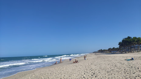
Where is located Praia do Porto das Dunas
Praia do Porto das Dunas — local attraction, which is located at no data and belongs to the category — -. Average visitor rating for this place — 4.7 (according to 63 ratings, information from open sources and relevant for 2022).
Exact location — Praia do Porto das Dunas, marked on the map with a red marker.
You can get directions to Praia do Porto das Dunas on the map from your location.
What else is interesting in Aquiraz? You can see all the sights if you go to the city page.
Coordinates
Praia do Porto das Dunas, Brazil coordinates in decimal format: latitude — -3.850601565765412, longitude — -38.387707507380846. When converted to degrees, minutes, seconds Praia do Porto das Dunas has the following coordinates: -3°51′2.17 north latitude and -38°23′15.75 east longitude.
Nearby cities
The largest cities that are located nearby:
- Fortaleza — 24 km
- Maracanaú — 26 km
- Caucaia — 36 km
- Mossoro — 183 km
- Juazeiro do Norte — 382 km
- Parnaíba — 389 km
- Natal — 408 km
- Parnamirim — 409 km
- Campina Grande — 459 km
- Teresina — 504 km
- Timon — 507 km
- Santa Rita — 519 km
- João Pessoa — 527 km
- Caruaru — 552 km
- Caxias — 558 km
- Camaragibe — 589 km
- Recife — 599 km
- Jaboatão dos Guararapes — 601 km
- Petrolina — 649 km