
 Belém
Maranguape
Paranaguá
Paranaguá
Monte Alegre
Alvorada de Minas
Bragança
Laguna
Ibiporã
Belém
Maranguape
Paranaguá
Paranaguá
Monte Alegre
Alvorada de Minas
Bragança
Laguna
Ibiporã
Pine Farm (Fazenda do Pinhal) on the map, Itirapina, Brazil
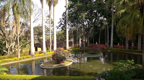
Photo
Where is located Pine Farm (Fazenda do Pinhal)
Pine Farm (Fazenda do Pinhal) — local attraction, which is located at Rodovia Municipal Domingos Innocentini, Km 4,5, s/n - Zona Rural, São Carlos - SP, Brazil and belongs to the category — historical place. Average visitor rating for this place — 4.8 (according to 227 ratings, information from open sources and relevant for 2022).
Exact location — Pine Farm (Fazenda do Pinhal), marked on the map with a red marker.
You can get directions to Pine Farm (Fazenda do Pinhal) on the map from your location.
What else is interesting in Itirapina? You can see all the sights if you go to the city page.
Coordinates
Pine Farm (Fazenda do Pinhal), Brazil coordinates in decimal format: latitude — -22.119530536398827, longitude — -47.82268491179016. When converted to degrees, minutes, seconds Pine Farm (Fazenda do Pinhal) has the following coordinates: -22°7′10.31 north latitude and -47°49′21.67 east longitude.
Nearby cities
The largest cities that are located nearby:
- São Carlos — 28 km
- Rio Claro — 31 km
- Araras — 46 km
- Piracicaba — 56 km
- Araraquara — 64 km
- Santa Bárbara D'Oeste — 69 km
- Americana — 73 km
- Sumaré — 83 km
- Hortolândia — 90 km
- Botucatu — 94 km
- Campinas — 105 km
- Indaiatuba — 111 km
- Ribeirão Preto — 120 km
- Itu — 123 km
- Bauru — 127 km
- Jundiaí — 139 km
- Poços de Caldas — 139 km
- Sorocaba — 143 km
- Várzea Paulista — 146 km